Tuesday, September 10, 2019

Training for Marine Corps Marathon: Week 11

Somehow, I have no recollection of last weeks training.

From what I recall (foggily) It was another nice, cool week of training and my calf/shin was reasonably cooperative. I managed to do all my workouts and fit in a small hike.

I shall now refer to Strava.

OK right. It was a good week!

I started things off on Monday with a treadmill run because it was a cold, rainy mess. Normally, this would REALLY not be a good way to begin the week (I am REALLY over the treadmill) but it was actually a solid 5 miler.

I did 6x800 for probably the 300th time this season. Every time I do this workout, I have plans to up the length of the repeat the following week. THEN, something happens to keep me from doing that. So anyway, they were fine, and hopefully this week does not such and I can run some damn mile repeats.

I ran a 15+ long run on a gorgeous day. 68 degrees, dry, sunny and wind. Doesn't get better, and the whole run was very solid.

Massive post run beer, haha
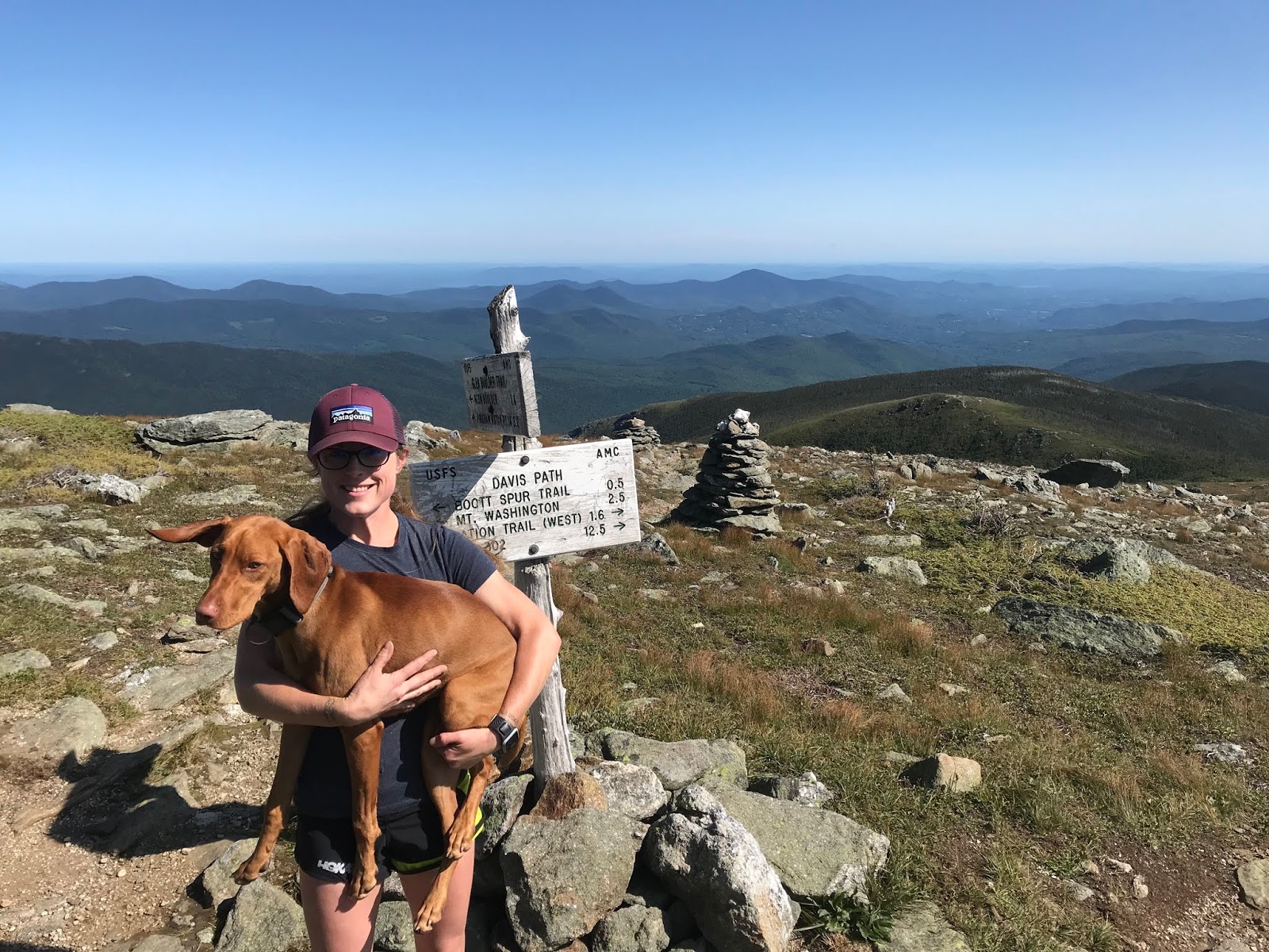
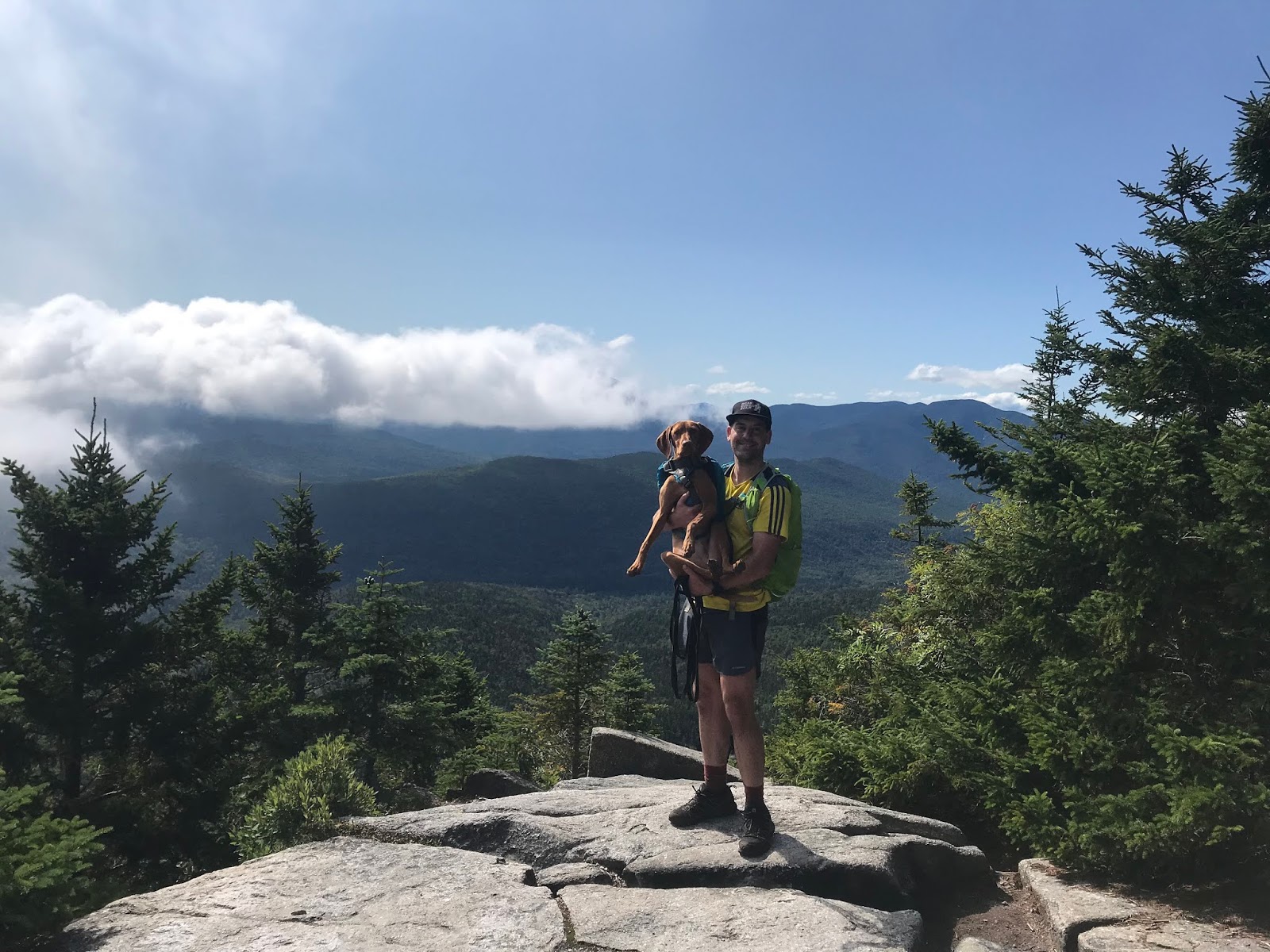
We did an 8 mile power hike on Saturday. This was NOT counted as a run, even though we ran some of it. A rugged 3500+ of elevation too. It was our first time this season in the Northern Presis, and they never disappoint.

Heyyyyyy
Sunday was another gorgeous day, and I finished the week up with a pretty casual 10 miler.

So it was a decent week. The next couple are going to be really challenging. Work is insane, I mean INSANE. (like, 10-11 hour days 6 days a week and then Finals, which is basically a week long.)
I'm pretty determined to get the work done. Marathon time is drawing near, and I certainly can not afford another significant break at this point. (and then, I'm traveling early October... so lots of potential pitfalls. noooooooo!!!!)
The cooler weather is making me feel much more like myself. (and at the same time, fills me with dread because it is going to suck when it is suddenly 85 again!)
And as far as my calf goes.... It is no worse. It hates it when I am on my feet teaching for hours at a time, but it needs to suck it. I literally have no time to listen to its bitching.

Boston registration is this week. I'm looking forward to seeing what the cut off times are, after the qualification standards became tougher this year. Clearly, I would love to mosey to DC and low key (on low key training, haha) BQ. I think the next two weeks will be really telling in whether or not that is a reasonable goal. I have 9+ minutes in hand for 2020, so I am confident that I'll be lining up on April 20th.

Stats:
Miles: 38
Hottest day: Not hot at all. No hot days. Pretty chilly. 
Longest run: 15+
Hiking miles- 7.9

Wednesday, September 4, 2019

Training for Marine Corps Marathon: Week 10. Oh shit

OK. So time is moving terribly fast.
While my off time was completely required, I am feeling a bit behind in the marathon training department. We shall see if I can whip myself into shape in the time remaining.

So the good news: my calf/shin is certainly better. Not 100%. But close enough, and doesn't seem to be responding negatively to work.

I had a couple basic runs Tuesday and Wednesday to get back into the swing of things. I did unintentional speed work on Wednesday, in an attempt to out run some rain.

Thursday was 11 mile long run day and it was fine. A short "long" run, but it went well.

Saturday, we climbed Moosilauke which was right around 8.5 miles.

How we enjoy a day off
And then on Sunday.... We headed out to preview the course for this absurd race that Eric is signed up for. "Ridge to River" I believe.
Words of wisdom: Don't do it, but instead spend the day repeatedly closing your feet into a piping hot George Foreman grill.

I was expecting a "trail run" and it was a god damn mountain climb. Almost 4k of elevation in 10.5 miles.
You can't even tell how steep it is
It was shit. Like actual shit, not like "the shit."

View from ABOVE the chair lift
And we didn't even make it the whole way! Which, of course, pissed me off and I'm planning how to conquer the whole trail.

You made me upset, trail

So let's see.
What is good:
-the leg is getting better
-as long as I can actually run, I am doing my best
-the weather (much cooler) (also, see bad)

What is bad:
-Well, I would like to be more fit
-At this point I would like to see both my speed work, and long runs longer....
-The weather: if it is hot on race day this nice cool spell will spell certain doom!

Stats:
Miles: 31.2 (with one million feet of elevation)
Hottest day: Not hot. I think my warmest run was 79
Longest run: 11
Hiking miles- 8.5

Signature

Friday, August 30, 2019

Isolation! August 25, 2019

The night before this hike, we had decide not to attempt Isolation. The Saturday weather had not been as good as forecasted, we were a bit tired from Zealand: the extended version. And REALLY, who wants to get up at ass o'clock every day??

So, when Eric got out of the tent at 6:45 on Sunday morning and said "SHIT. We need to hit Isolation today!" I was both excited, and freaked out because one would have planned on an earlier start.

But yes, the sun was shining gloriously and there was not a doubt in our collective minds. It was a day for some above treeline nonsense.

We managed to get on trail exactly 9:30- which is a hideously late start. Thankfully, sunset is still on the later side so were not too worried. I had heard wildly varying times for this hike but calculated that we should/could be able to do it in 8.5.

And off we went.

Not too gross after a couple days in a tent
We chose the Glen Boulder trail to start with, and it gains some serious elevation right from the beginning. However, it tosses in some switchbacks, and moderate sections (so as long as you don't go out habanero- you will make it. We certainly saw some humans around mile .75 who were DONE for the day. Don't be those guys.)

Just normal up and up
As the trail pops above the treeline for the first time, there is the only technical scramble of the day. Our typically fearless dog took a good look at this little rock slab and asked for a boost. She was then on her way and had no other issues (this is just good to keep in mind if you have a cautious/old/arthritic/non-athletic dog. they might not make it up this.)

The view looking towards Glen Boulder was stunning. It was a perfect weather day, in beautiful surroundings.

Just a small rock on a hill 

It's kind of amazing that such a large rock decided to settle in this exact place. Let's hope it stays put.

Ellie is like, 50 feet away for perspective
After checking out the boulder, we continued to go up. A stretch of above treeline hiking, then  transitioned into some more wooded path.
There is a spring off this stretch of trail: be aware, this is the only easy place to get water for the remainder of the hike. If you have a dog, make sure to bring a LOT of water!

On the way to the intersection of Glen Boulder Trail, and Davis Path, you pass over a summit which is called Slide Peak, or Gulf Peak depending on what map you look at. While it is right at 4800 feet, it doesn't "count" because it doesn't have prominence. BUT- it has some killer views.

Right at about 5100 feet, 3.2 miles in, you come to the intersection with Davis, and make the left turn towards Isolation. (by the way, this was Ellie's highest climb!)
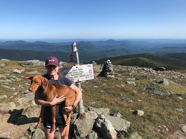
Can't beat the weather, or the view!
And then. YOU GO DOWN.
Might as well enjoy it though. The sights just don't get any more gorgeous.

Isolation, here we come
The little above treeline stretch was just glorious, but luckily, we both really liked the wooded sections too. You really drop like a rock, losing over 1k elevation pretty damn quick. You're going to hoof along in the woods for about 2 miles- and they aren't bad miles at all!! Then, you'll come to a fork in the road and take the right hand trail towards Isolation. Only another 0.9 to go at that point...!

A pleasant trail!
There are some pretty muddy areas on the Isolation trail, and I imagine it is a gross mess in the Spring. But I didn't take any pics that weren't pretty, haha.

And just like that (well. after almost 4 hours) there is was!

Yay!
Just a small climb and POP, above treeline you go.
To some of the best views you can hope for.

BEST VIEW
Just kidding. It was lovely.

Gotta get back up that, though
We could not have asked for better conditions. Save this one for a glorious day!

We made it!
We made it to the summit in almost exactly 4 hours. We did have to stop several times to water and feed the dog, and for minor outfit changes. Nothing major though.

After enjoying about 10-15 minutes at the summit, we were off again. Knowing we had a pretty solid climb in the way down was a good motivator not to dilly-dally.

The return trip was, honestly (and thankfully!) uneventful. Yes, there was a climb to get back to Glen Boulder trail. But: it was such a nice day, the surroundings were so fabulous, and we are in decent shape, so it was not at all horrible.
We retraced our steps, as I have heard that Rocky Branch is not in good shape. Plus, we don't always trust our hitchhiking skills.

BACK UP WE GO!
Gotta take a few to check out the view.

Just out of the tiny woods
Shadows were beginning to fall by the time we made it back to the big big rock.

Casts a large shadow
It was a good walk down. We had braced ourselves for being really tired, which never actually came to pass. We braced ourselves for some level of frustration, which also never happened! The dog got a little crazy at the end, but saved it for the final stretch so that wasn't even an issue. We had prepared for a real level of struggle (especially after hiking 12 plus the prior day) but it never was that bad. We had some good laughs on the way down, the trail is impeccably marked so we never had the "oh shit where do we go" feeling, like we had on the Twins, and it was a fine ending to a truly fine hike!

Elle is so embarrassed 
This was a great one.
Don't do it if you aren't in shape.
(good to note: there really is not a "bail out" option on this hike. so if you can tell it is not your day, head down earlier rather than later.)
Save it for a nice day!
AND ENJOY.
Also, this brought us up to #28 on the NH48 list (I believe, the 21st one we have done in 2019!!)  I really have to appreciate the list for being a motivator to get out and do a hike like this. Otherwise, I might have said "11.6 miles for a little mountain?!? NO WAY!!" And thus, would have missed out on a really fun day.


Strava data: (we take this with a grain of salt) 
-elevation climbed: 5,007 (HELLO!!!!)
-miles covered: 11.6
-elapsed time: 7:58

Difficulty: Strenuous. Very long, lots of vert. But amazing!!!! Very exposed in places, not a great option for a bad weather day. This route avoids major water crossings, but it can certainly get very muddy. You are, indeed, isolated out there. No viable bail out routes that would help you in a bad situation, so you must be smart to do this one. I did find some cell service in a few places, but it's very spotty. 

Views: Unbeatable. Even if you only go to Glen Boulder. 

Bugs: Nope

Dog friendly trail? Ish. One tricky scramble, and very long with very little water. Our little buddy loved it, but she's nuts. 

Signature

Thursday, August 29, 2019

Training for Marine Corps Marathon Weeks 8&9

Week 8 was, as planned, a zero week. (this would have been the week of August 11th.)
Since it seems that my crappy blog will not allow me to comment on comments (dumb) here's my answer to why I like a nice, sensible, zero week.

Well... Possibly because I'm just not a high level runner? I am quite sure that if I was shooting for a big goal, a low key week would not be ideal (or maybe it would!) I find that taking a really massive cut back week, or zero week, allows me to fully recharge.
I have found myself in the position of being forced into a zero week for my past couple marathons. Maybe I get super sick, or hurt my stupid back. Whatever the reason, I seem to come back from a rest much better.
Maybe I should always rest, and never train....?

As it turned out, I would have needed to quit running for that week anyway, whether I had planned to or not.
Since my hobby (hiking) is pretty active, and my job can easily keep me on my feet for double digit miles a day, I had sustained some minor injuries.
I managed to turn my ankle pretty badly while WALKING AROUND, which is possibly the stupidest thing I have ever heard.
Add to that some shin crap that I managed to collect while hiking, and I was a gimp. I actually (unfortunately) had to extend the rest into week 9- which was not my plan. I saw my Chiro and got some major work done (all feet and ankle crap. so much of it.) That really helped, so I hiked almost 25 miles total last weekend, beat myself up, then got back to training.
I did make it out for a 3 mile run, but it never made it onto Strava because my watch is screwed up...

In the big picture, 2 weeks of no running are not ideal in marathon training. But, if I had not taken them I feel that the odds would have been against me and I'd probably be on the injured list later in this cycle. (or, NOW.) My hope is that the break, and the work I have done to rehab will get me to the start line.
(if I was a more serious runner, I would probably knock off the huge hiking weekends. but that is probably not going to happen.....)

So.
Stats:
Miles: 3 :-)
Hottest day: 90, while I was at a horse show. So this sucked. 
Longest run: 3!!!!!
Hiking miles- 24.2 Maybe this is good for marathons???

Signature

Wednesday, August 28, 2019

Zealand: The extended version. August 24, 2019

Eric, Ellie and I went camping over the weekend.
Since we were already ON the Zealand Road, we concluded that it only made sense to hike Zealand.

It seems to be a little talked about Mountain- people seem to tie it in with Hale (smart) or snag it during an extended Pemi (less smart??)

We got up, the weather was decent enough (cold!) we drove a couple miles up the Zealand road to the Zealand Trail lot ($5, packed, typical) We parked in the Zealand lot which connects to the Zealand trail and takes you to the Zealand hut and Mt. Zealand, BECAUSE EVERYTHING AROUND HERE IS CALLED ZEALAND! I think this is very amusing.

And we made a STARTLING DISCOVERY!!!!!


OH MY GOD?!?!?! IT IS??? 
I admit, the Thoreau Bridge closed signs are mostly a joke between Eric and me (and maybe not even a funny one...) But Eric and I find it very amusing, every time we come to a bridge, to politely ask one another if it is the Thoreau Bridge. And then shout "IT IS OUTTTTT!"
We think we are funny.

Anyway. It was like 45 degrees and off we went. 
Zealand Trail was very polite.

Yes please
THEN. Zealand Trail went through a swamp, and I LOVE SWAMPS!!!

Thoreau bridge!!!! Nope...
OMG stop. I love it.

It was a bit cloudy though to be honest. 
Anyway. We chugged along on the flatlands for a few legit miles, and then the trail turned upward by Zealand Falls, and headed to the hut. The trail to the hut which covers 2.8 miles, literally goes up 700 something feet. It is the least hard thing you will do all summer.

The only steep stretch in the first part
After passing by the hut you transition to the Twinway (the AT) which continues to be very reasonable, although somewhat more uphill. You pass over some little flumes, along some pretty rocks and through a lovely forest.
There is a viewpoint just before the Zeacliff trail that should not be passed by! This is right around 3.7 miles, by a sign that says "view". The sign is correct.
From what I understand, this is "Zeacliff" which makes sense, as it is a cliff. This is a tad confusing, since on the actual Zeacliff trail is another perfectly good Zeacliff. who knows.

Beautiful!!!
From there, the trail continued to be so enjoyable! Well marked, so obvious, perfectly maintained. Just delightful.

Doesn't get much better!
There were, as expected, a few uphill stretches but they were broken up perfectly by easier terrain. There were a couple (few) rock hops, the smallest of teeny baby scrambles, and one steeper section with a very doable little climb, and helpful ladder.

Mostly though, it was fun and straightforward.

Ellie approved
And soon: there we were!

YAY!
A pretty low key peak.

Another one in the books
We met several very friendly and interesting hikers at the top, and spent a while talking about our shared  experiences. We were in no rush on this particular day and thus, spent a decent amount of time talking to fellow hikers.

Now one might think that the best choice for the return trip would be the same sensible, enjoyable, easy to follow, pristine trail that we had just taken.

But no. We wanted a view, and some rugged, wild, messy wilderness.
So we took Zeacliff....

It did not disappoint!!

On a cliff. ANOTHER ZEACLIFF WHAT THE HELL. 
In stark contrast to the friendly for all, almost Disneyesque features of Zealand Trail and Twinway, Zeacliff was a wild little adventure. Plummeting into a valley that leaves you staring into the face of whitewall, there is little question that you are taking the path less traveled.

Jurassic Park??
The trail is mostly easy follow but infrequent blazes should merit some caution. The trail is plenty full of adventure- and would be a cardio nightmare to ascend!

After plummeting into the lowest point on the planet, you go up a bit (steeply) cross a river, and come face to face with Whitewall Mountain (which I did NOT want to go up!)

Straight UP
After a bit of "find the cairn" and some rock-hoppity crap:

Rock Hoppity CRAP
...we ended up securely, as planned, on Ethan Pond Trail (actually passing by Thoreau Springs trail- don't tempt us to find the bridge vacancy!!!)

Ethan Pond trail brought us back to a very practical place on a totally sensible path. Very pleasant.

Very nice. 
Back to Zealand trail, back through the glorious swamp, and back to the campsite!!!!

Fun!!!
This was a very enjoyable day. What a great hike!
While I hesitate to call any double digit hike "moderate" this is what a moderate long hike looks like, in my opinion. (probably a great idea to tag Zealand and Hale- another hill I like- together. But I'm actually pretty happy that we did them separately! They can be enjoyed in their own right!)
For the easy route, skip Zeacliff (the trail. not the scenic viewpoint. I know..... ) We had the time/fitness and it was fun. I imagine going up is good workout, and going down could be a bit gross if things are wet. Be mindful of where the trail is in the overgrown places!!


Strava data: (we take this with a grain of salt) 
-elevation climbed: 2,867 (not at all bad for so many miles!)
-miles covered: 12.6
-elapsed time: 6:47- includes all time chit chatting 

Difficulty: Moderate. But only if you skip Zeacliff and the extra mileage 

Views: Nothing from the summit (people hate this!) but a GREAT viewpoint 

Bugs: They seem to be gone

Dog friendly trail? Stick to the basic route- VERY dog friendly! Zeacliff has a pretty good sized slab/scramble/climb which, while very short, could be a pretty big question for most dogs. 


Signature