Tuesday, October 30, 2018

Hiking in the Pemigewasset Wilderness: Lincoln Woods/Wilderness/Bondcliff trails.

At some point during the hot, oppressively humid, and generally disgusting summer weather I began to think about fall hiking. Knowing that I was straight out at work until mid October I began to concoct a plan. I concluded that on October 27th, after having a few days to catch my breath post insanity, Eric and I would head to Lincoln to climb Bondcliff (and maybe peak bag Bond if the weather was good.) I locked the day down ages ago, really looking forward to a final long hike in ideal conditions.
Back in July, an October trip to the wilderness seemed great!
I was imagining cooler weather (at the time, and after such a hot summer, I was assuming 50's) amazing foliage, and a day to relax and enjoy the mountains.

Right.

The weather has a way of doing what it wants. And what it wanted to do was snow. And be really cold. And windy.

I tracked the forecast (as one does) and concluded that if we started early, we could reach the peak of Bondcliff and bail before things got ugly. (with 100 km per hour winds scheduled for 7PM there was NO WAY IN HELL that we were risking a late day.) The Lincoln, NH area appeared to be getting mostly rain, and it looked like we might see a bit of snow on our return trip to Maine.

Wishing to get an early start, and not really relishing the notion of yet another 1:30AM wake up time, we drove to Lincoln and stayed the night before. We love the "off" season, because it makes staying over a reasonable, and affordable option.
I avoided watching the 18 inning Sox game, and we awoke (somewhat exhausted) at 3:30 AM (basically when people were finishing up drinking beer/watching the game, and switching to drinking coffee/getting ready for the first day of the Maine deer hunting season.)

The weather was just fine. 33 degrees. No precipitation. No wind.
We drove to the Lincoln woods visitors center in the dark, paid our $5 to park with the other 3 cars, and made our way to the trailhead. The place was deserted. (just the way we like it!) But also not a day to get ruined out on the trail, and hope for other hikers to wander by and offer aid. So, with our safety first mindset firmly in place, off we headed into the dark.

The suspension bridge over the Pemigewasset River
And were immediately warned about the bothersome bear. (clearly, this photo was taken on the return trip...)
Watch out
Armed with our usual headlamps and such, we struck off on the Lincoln Woods trail for 2.9 miles. It was BONE FLAT, and we covered this section in less that an hour. It was a great way to warm up, and to figure out our layering strategy to stay dry/warm throughout this long, flat section of trail.

Typical dark start. 
Honestly, this was basically a walking path. Later in the day, despite the weather, we saw many usual walkers, families, and children strolling along this path. (so. very family friendly.)
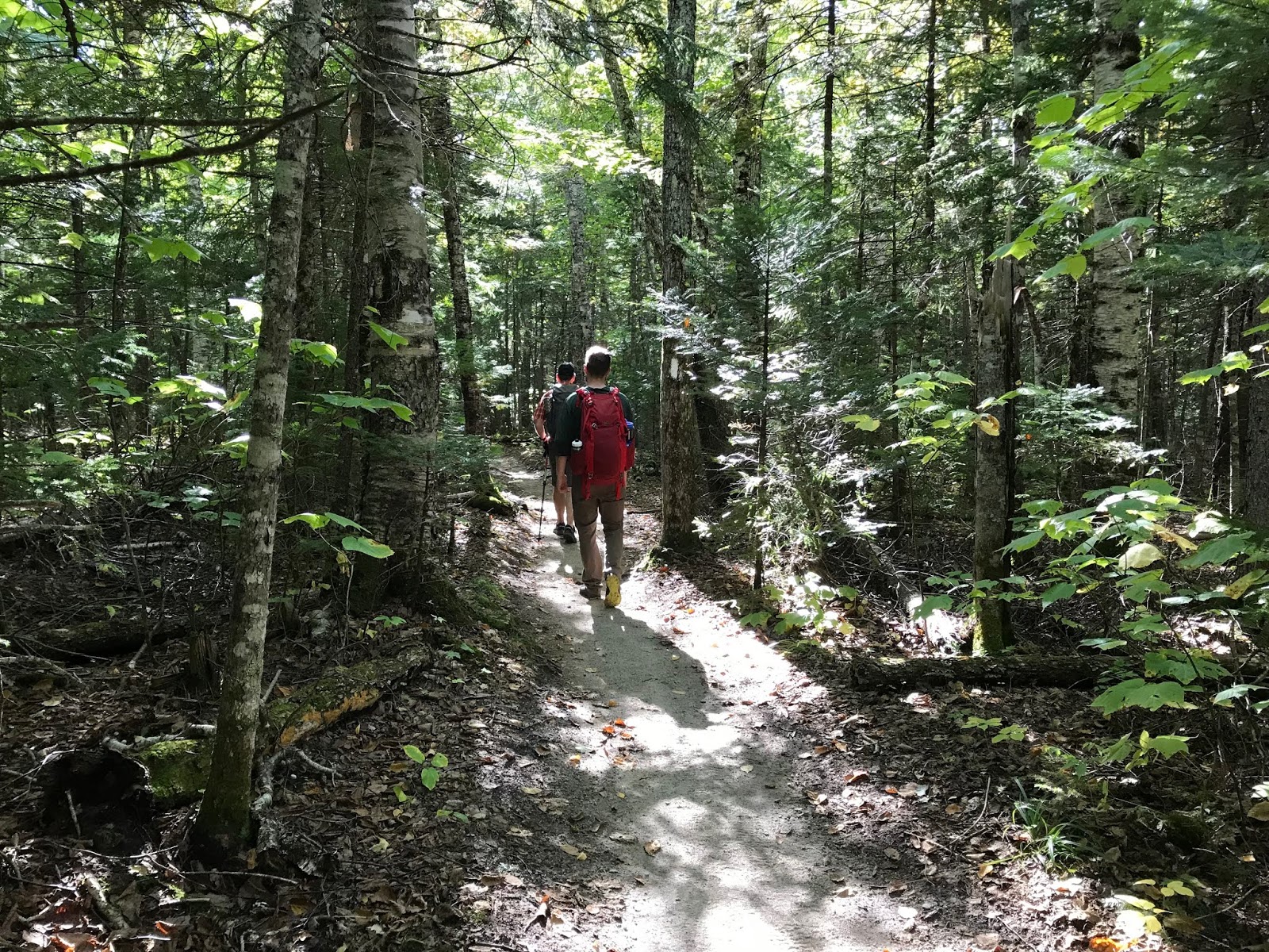
This trail is an old railbed, which means you'll be seeing a lot or railroad ties, ironware, as well as remnants of old logging camps. When we made our return trip in the daylight, it was definitely interesting to look around and take in the history (although I'm a bit concerned that when we do the Pemi loop at some point, that we might all die of boredom during the miles of endless flat!!)

After the 2.9 initial miles, you go over a suspension bridge and the trail is no longer very bike friendly (or, bike legal.) The trail, at that time becomes the Wilderness Trail (with zero fanfare) and while it narrows slightly, is still completely flat. We really motored this whole section, averaging over 3 MPH (this would be a very easy section to run. but we carry too much stuff.)

We did have a bit of trouble finding the junction where the Bondcliff trail veers left around mile 4.8.

It would be helpful to have this trail marker where the trail turns left. But nope. (so don't turn left when you see this sign!!)

We came to what appeared to be a stream crossing, and, with our eyes being drawn across the brook to a "no camping" sign (very reflective off the headlamps) we crossed the icy stone brook (where I promptly slipped, dunked my whole foot, and had to do a hasty sock change.)
After puttering about for a bit, and consulting the map, we turned around. Thanks to the increasing daylight we were then able to see the sharp left turn (and the very, very faint light blue blazes that would continue to appear *sporadically* for the remainder of our trip.)

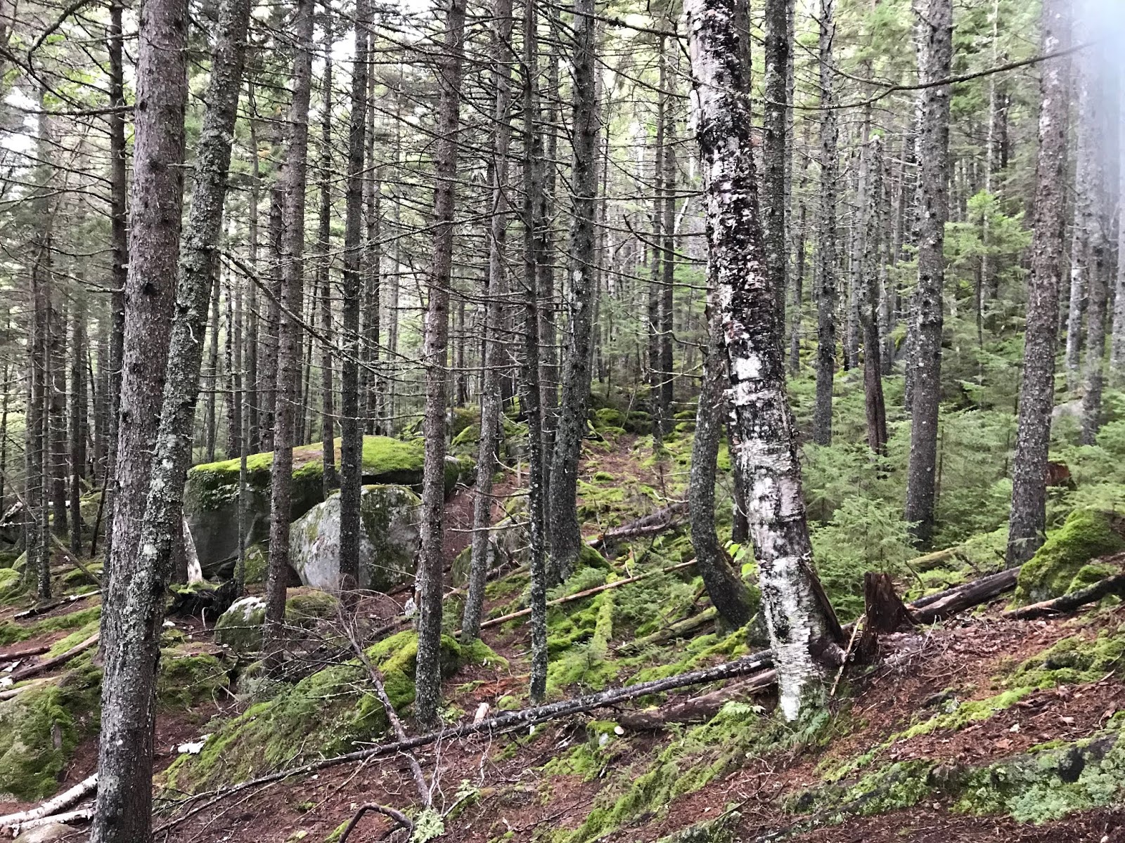
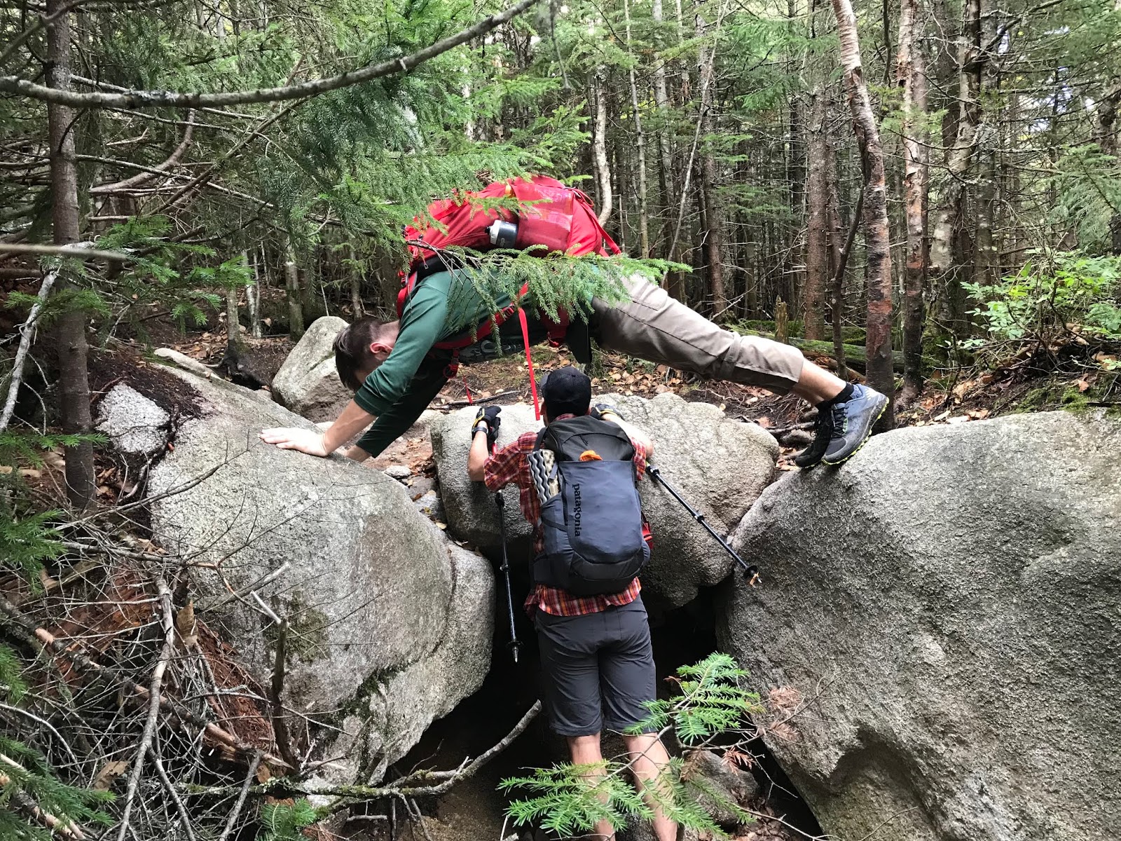
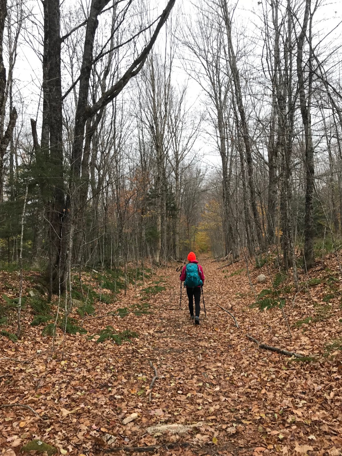
After that little misstep, we continued without issue. I will say though, that this stretch of trail was not well marked at all, at least to the more casual observer (which I am not, as I do not wish to become lost in the woods.) The trail was heavy with fallen leaves, and in some places you really needed to be quite observant about where you were going. Probably solid advice, no matter where you are hiking.


There were a couple miles of winding, very wooded trail with some fairly dry stream crossings. I imagine these could be problematic in seasons with snow melt, or heavy rain.

One of many stream crossings
Compared to what we have come to expect in the Whites, there were few rocks. (don't get me wrong. There were some. But nothing compared to the boulder city of Madison, etc)

Very typical stretch of the lower part of the Bondcliff Trail
Gradually, we began to find the remnants of a fairly big storm that the area had experienced several days before. While some of the White Mountain region got a few feet of snow, there were only a few inches here. And someone had kindly tramped it does for us!

Just a bit of snow
For the most part, despite the continued lack of blazes, the trail was easy to follow. There was a fairly twisting section at one point which may have been challenging to follow, if we were not following footsteps from the previous day. With that one exception, you essentially follow the narrow path.

As we climbed, the snow become deeper but was not at all problematic. It actually managed to nicely pad some of the rocks, which were surely buried underneath! While there were a couple steeper sections of the trail, they were fairly short lived. The hike is more of a slow and steady climb. You have just over 9 miles to reach 4,265 feet so you won't be redlining the whole thing.

Knowing that we were just ahead of a pretty major winter storm, when the wind took on an ominous feel we decided to play it safe and turn around (even though we were sooooo close. We probably had about a half mile climb left to go.) Oh well though, it is better to be the hikers who bail, than the hikers who need the heli evac (and even though Evan was not with us, our summer long "Heli Evac" chant certainly came up once or twice...)
Winter in full effect
The decent was straightforward and flew by. Before we knew it, we turned right onto the Wilderness/Lincoln Woods trail.
One still gets tired after a 17 mile day, even if some of it is flat!
We then proceeded to zip along for the 4.8 miles of bone flat superhighway back to our car.

Bone Flat Superhighway
With about a mile to go, the freezing precipitation began.
On a nice day, we would really have enjoyed the scenery more (that's going to be the plus side of the endless, pin straight, pancake flat final section of the loop. We will at least have things to look at!) We chose not to take the .4 mile detour to see Franconia Falls, which we have heard is fantastic. We basically just put our heads down, and trudged on. (and looked at the bridges, because I love them.)

I've never met a bridge that I didn't want to take a crappy photo of
After going the whole day with zero human sightings, the floodgates opened and we saw a ton of people. Clearly, the Lincoln Woods Trail is very popular for the family walk crowd, even in crap weather, and I imagine it is a complete zoo in the summer. I believe there are some swimming holes in the river, that are very popular.

Much of the Lincoln Woods trail is next to the river
The temperature remained at freezing all day, (although it was much colder when we were close to the summit.) Basically, shit was frozen.

Pretty though
We made it back, uneaten by the bear.

And honestly, with the weather rapidly worsening, we were not disappointed that we had turned back.

You can see the ice on my hat


The drive home was a shit show of epic proportions. The end.

Fucking aggressive 

Stats:
Time: 7 hours 10 minutes (included around 30 minutes of trail location in the dark....)
Mileage: 16.9
Elevation gain: 2,630
Challenge level: Easy/Moderate. The almost 10 miles of flat made the one of the most straightforward hikes we have done. The climb itself was also pretty benign, although we missed the one lone scramble at the end. I suppose I must give this hike a moderate rating due to the distance, and the need to be extra attentive to the route at times. However, I would certainly give it an easy for terrain. You could most definitely bring your non-hiking friends on the first 4.8 miles of this trail with zero issue. 

Signature

Friday, October 12, 2018

Bradbury Mountain Bruiser 2018 (Summer goal of becoming a BADASS achieved!)

Well, considering that I managed to check off my goal of reaching "badass" level at this event, this certainly is a delayed reaction post.

Several weeks ago (September 9th, to be exact) on what I believe was the first day of the year cooler than 90 degrees, Eric and I tackled the infamous Bruiser.

How quickly it goes from 90 to 40. And back to 80.

This is a tricky 12 mile race, on the"non mountain" side on Bradbury State Park. Don't let the "non mountain" statement trick you- it is a winding, rolling course, that finishes up on the rather dreadful "O-Trail". A trail so menacing, that it looks like intestines when you look at it on Strava. Gross.
This race always measures short, but it because it is LITERALLY so twisty, that no GPS in its right mind can keep track of what you are up to.

So. The day arrived. THE BIG DAY! I was not feeling fit at all. I really broke up with running this summer (temporarily... we were just on a break) and I was wondering how 12 miles would feel to my out of practice legs (spoiler: not great.) Regardless, I was determined to complete the race and collect my prize. I was NOT going to let the Badass sweatshirt escape my grasp, even if it meant I had to crawl, gasping and sobbing to the finish.

( you might be saying ....all this drama for a sweatshirt??..... and I will answer. YES. YES!!!!!!........)

Shockingly... We were quite late to the start and had to run to get there on time.

We are running to the start. But there's always time for me to take a pic!
Luckily, we made it in the nick of time. We started and made sure to be closer to the front of the pack than last year.
Which makes perfect sense, when one is in absolutely dreadful running shape!

But listen, what happens on the very narrow trails is a complete bottleneck. And if you are in it, you are IN IT. So we avoided it and were happy.

We ran mostly alone for quite a while. The weather was nice, we were winding and twisting around the trails, hopping over roots, and generally having a good time.

ALOOOOOOOOONE
The thing about a 12 miler, is that eventually you aren't going to be super happy if you haven't been running more than zero miles at a time.

Overall my suffer score was moderate. MODERATELY HIGH. (JK. it was only moderate)

I had some really unpleasant stabby left ankle pain for the majority of the race. It was pretty nasty, but I am pleased to say that I haven't had any issues with that since (but I also have not been trail running since.) So who knows what that was about, but it was distracting, ouchy, and stupid.

Eric and I ran together until just before the O Trail, when I went somewhat ahead in an effort to run with some people who we had met the previous year. They clearly had been training more that I had, and I was not able to keep up with them.

But... I was lucky enough to find someone to follow through the dreaded labyrinth of the big dumb O.
Basically, on the O Trail,  you run around and around, and back and forth, and up and down until you get dizzy (all to the tune of "if you're happy and you know it." you think I am kidding, but I am not.) It's bad enough to run it with people to draft off of- and would be miserable to run alone. I was very, very glad to have a leader.

THIS IS SHIT (photo cred to Eric)

And then. 2:05:49 later, I was done. Thank the lord!
Sweatshirt in hand!! A real, honest to god badass!!!

A pair of badasses
And shockingly, inexplicably and undeservedly I was about 25 seconds faster than last year. I attribute that solely to the avoidance of the bottleneck in the first mile, and nothing more (because seriously, I ran about 13 miles in September. 12 of them on this day...)

I'm looking forward to doing this again next year. I REALLY love the Trail Monster races, and think that they are a great organization and that they put on really special events. If I ever decide to woman up and run summer miles, I would love to do the October ultra that they host. I feel like if a 12 miler is this much fun, a 30 miler would be even better (with better fitness.. and a non stabby pained ankle!)

The most remarkable thing about this race is that I did not fall!! (miracles do happen)
The second most remarkable thing is that it was a cool day (this summer was a pain in the ass)
And the third most remarkable, is that one can actually run 12 miles without practice. Although I do not really suggest this!


Signature

Thursday, October 4, 2018

Camping after a 30 year hiatus, Katahdin Stream Campground, September 2018

When I was a kid, my sister and parents and I would go camping frequently.

Not like, glamping, with a cabin, or a Winnebago, but real old fashioned camping in a tent with meals cooked over the fire.
I have very fond memories of these times (especially sneakily feeding the squirrels and gray jays at Cobscook Bay) BUT THAT ALL CHANGED, ON ONE FATEFUL TRIP.

What happened? Well, it snowed. And not just a little but like a foot. It was cold. We were little kids. I basically hated it so much that I quit camping for my whole life (my Mom did too, she was done after that nonsense) (oh, and Lee remembers it somewhat differently than we do. "it snowed a little" he claims "and it was kind of cold. what's wrong with that??" DEATH, Lee. DEATH is what is wrong!)
Well, now I might be able to suck it up but at 8 years old it felt like quite the disaster (and it was god damned ridiculously cold.)

Lee still goes camping all the time. #mental
And so does Eric.
And so do my cousins.
They always come home stinky like a fire, full of fun stories, and bursting with glee.
(this has done very little to change my standpoint. to me, camping is staying in a sketchy hotel.)

For a moment, we should reflect upon the fact that 10 years ago I really hated running, and could not imagine a worse way to spend my time.
Things change.
So I know to keep an open mind.

So all of a sudden, after our Presidential Traverse trip with Evan last month, we began to talk camping.
The motivation (for me, anyway) was to be able to experience Katahdin, and Baxter State Park. I had never been there, and I was definitely interested in seeing that part of Maine. And walking up hill, as one does.

We talked about possibly getting a posh cabin (but they were booked for the rest of my life) so Lee suggested a lean to. Since he has ample photos of every camping trip he has ever been on, he was able to provide photo evidence of said lean to. Which looked quite cozy.

Cozy Lean To
Knowing how long sites last in Baxter (NOT long) we booked a couple sites at Katahdin Stream Campground. Conveniently located at the Hunt Tail head, the exact place where we intended to begin our hike. This was a bit of a risk, because none of us had any idea if we could actually manage to get time off from work (clearly we did. a bit of a miracle, to be honest.)

The trip was nuts.
Evan worked an overnight until 8AM on Wednesday and then drove straight to Maine.
I had to work until 1:30 on Wednesday.
Somehow, Eric managed to get the day off, but was definitely taking calls the whole drive up.
BUT WE PULLED IT OFF!! (departing on Wednesday, at 1:30 PM)
(and I had to be back by 1:00 on Friday to work, and Evan had to drive straight home for another night shift. But we decided to worry about that later...)

Off we went! It's just over 4 hours to Baxter, and we beat the rain by enough to be able to unload, and get dinner cooking.
(and yes, it rained. but it did not snow! and it was like, 75 so NOT cold.)

We made it!
We split a 5 person lean to between 3 of us, which meant we had enough room to spread out a bit. (Lee got his own space because he is a party animal. or so that we didn't need to be sardines. you choose)

Getting cozy
We were able to make a fire, cook 99% of dinner (which was amazing) and have all our things set up before the real storm began.

Just before the storm....
After we ate, under cover of the lean to, pinned down the Guido Tent due to WIND! and RAIN!(which is like a tent that covers a picnic table that has a funny name in our family because #reasons) , we cashed it in and went to bed. It was late anyway, and had been a long day!
I had a super thick sleeping pad, and with the sound of the rain, the thunder, and the roaring stream in the background, I slept quite well!! (no rain the second night, but still nice stream noise)

There is the stream. 
The next morning, we got up and ate and hiked!! (but this story has been told)

When we got back from hiking I tried to start a fire.
And failed. I blame the fact that everything was damp (so I got a lighter, and lit that shit up.)

I am NOT the firestarter
We sat around my successfully lit (and often stoked) fire, eating sardines and huge blocks of cheese, and guacamole, and bacon and pancakes, and apple crisp (no shit. we ate like kings) I REALLY enjoyed tossing everything into the fire. Hay rope. Plates. Sardines. Cork. Nothing was safe. The fire was my favorite.

Proof. It's lit. 
We watched squirrels steal our belongings.
One spent a night in Lee's truck, and wreaked havoc on our snacks. Little fucker.

He found this cork... And ate it. OK. And then I burned it (cork, not wildlife. relax)
We had some very amusing conversation about trail names. I was not aware that trail names were a thing until a couple years ago. Now I am quite interested and amused by them.

The winners of the day:
-BushBaby (we need details, did you have a baby in a bush?)
-Box Turtle (why?)
-Terminator (awesome)
-SwampAss (well, we aren't sure if that is his name.... the others are real though!)

On the drive out, we saw the view that should have greeted us had the weather not been so ornery.

Impressive
It is safe to say that my first foray into camping after a lengthy hiatus was a success.
Several things contributed:

-Mostly excellent weather, no bugs
-Suitable accommodations (very pleasant)
-EXCELLENT food, which was a bit of work, but all worth it
-GREAT COMPANY!! Probably the most key factor in all of this.

Tips for wimps:
-Get comfy things to sleep on. Be posh. Don't suffer. Bring your pillow. Your jammies. The usual.
-Bring lots of lighting, I had a little lamp, a headlamp and a flashlight.
-Obviously bring a ton of amazing food. Don't eat sad ramen.
-Pack extra warm clothing. Even if you don't need it, it's nice to know that you won't freeze!
-Take your friends.

I'm not quite ready to buy a tent, and head into the back country (ummm. no) But I had a terrific time, and can't wait to try out my camping courage again next year.


Signature

Monday, October 1, 2018

Katahdin via Hunt Trail, September 27th 2018

Last week, in a completely whirlwind (and completely fun) 48 hour trip, Eric, Lee, Evan and I climbed Katahdin.

Yes, yes we did
Now, growing up with Lee (the hiking master) I know that I should be specific, and state that we summited Baxter peak. I grew up in Maine (with a hiking family, obvs) so I understand the layout of Katahdin. There is the highest peak, Baxter, which is famous for being the Northern Terminus of the Appalachian Trail.

The sign agrees
Katahdin has several sub-peaks, South Peak, Pamola, Chimney Peak, Hamlin Peak, and South/North Howe Peaks. (I have literally never met a person who has mentioned any peak other than Pamola and Baxter. But they, evidently, exist.)
Either way. We summited Baxter Peak via Hunt Trail, which is the final stretch of the AT.

We chose this route based on the convenience of the trailhead location, as we were luckily able to snag an amazing lean to at Katahdin Springs Campground. (mid week plans, for the win!) We were in camp site 12, and literally walked out the door and were at the trail head.
Katahdin was not on my radar earlier in the season, as the thought of camping makes me cringe. (and it's just not a day trip from where we live) As my hiking bug grew, and ridiculous adventures seemed more sensible, I decided to bite the bullet and take the plunge (I'm going to write a separate post on the fantasticness of this camping experience, and why I quit camping to begin with 30 years ago.)
(but this post is about the hike)

After a good nights sleep, we were all up and ready to hit the trail at 7:15. The weather simply could not have been better, which is the most remarkable part of this trip. (except the part where I slept outdoors, of my own volition.)

The weather was brisk (which prompted all of us to pack like it was going to be a Mt Washington wind/fog/death march) but the chilly start was just there to wake us up for a DAMN NICE DAY!

Slightly chilly at the start, and almost awake
The first mile, or so, of the trail was amazingly pleasant.

Perfect trail, and the best hiking friends!
We walked through the Narnia Forest (fun fact: this part of Baxter State Park was the inspiration for the forest in the Disney movie Bambi!)

Where are you, Bambi??
The terrain was a mixture of so-easy that your Grandma could do it, and occasional roots and rocks, and the classic bridge crossing.

Warmer. Enjoying the oh so rustic bridge. 
Right around mile one was Katahdin Stream Falls, which wins "best waterfall" for 2018.

Perfect
After the falls, the trail began to get more challenging. (so... leave Grandma at the falls!)

We trundled uphill for a while, and while there was the occasional rocky jump, or mysterious trail stream, I found this section to be more forgiving than most of the ascents on the White Mountains that we have accomplished this year.

Stone stairs are forgiving compared to some climbs
But don't worry, it was not just a casual walk up a bunch of stairs.

Just some rocks
But you also get great views, really quickly.

Double Top, wayyyy over there
Plus, when there are super big rocks, we always make use of them #dorks

So fit. This is now a hiking tradition for these two. Now figure up how to climb up THERE. 
We were lucky to get an amazing view of the Owl from a terrific vantage point (basically, a giant boulder. this scenic overlook has a name which I just can not recall at the moment.)

Hello, Owl
Very shortly after that point, things became serious. (as in: if the weather is bad, or you are unprepared, if you are already feeling fatigue, if you aren't up for a serious scramble TURN AROUND!)

We encountered a series of giant rocks, and the trail turned away from hiking, and into scrambling/light bouldering pretty damn quickly. Apparently, this is the beginning of the Hunt Spur. It's quite full of gigantic stones.

Yes, you need to climb up that!!
Through this segment of trail, you will encounter some very *tight fit* spaces, which could challenge a human with a large pack (or a human who has very broad shoulders.) You must scramble up some very steep sections, some of which are equipped with iron bars.

Good luck scrambling up to that iron towel hanger....
From ahead of us we heard Evan say "wow... that was pretty intense...." And if HE thinks that the actual, blazed route is intense. IT IS.

After clambering through the giant boulders, we came across a perfect and GOD DAMNED MAGICAL plateau to have lunch upon. And it was just amazing.

JUST. GORGEOUS.
The hike could have ended here, and we all would have felt satisfied (sort of)

We encountered some through hikers, and it was really cool to talk to them about their experiences, and how they were feeling with only a few miles to go. Hiking the AT is pretty impressive (and pretty luxurious if you want an unpopular opinion! but hey, being able to take 6 months off for hiking is pretty boujee if you ask me!)

So after hanging out in friggin heaven for a while having lunch, off we went.
Where were we going????

WHERE?? UP!!!!
We were going to tackle the remainder of the Hunt Spur. Thought you were done?? Nope!

OH HI (and that is NOT the top)
This section of trail should not be taken lightly, but I found it easier on the uphill route than I had the iron-bar-boulder section. I have since heard tales of people getting panicked from the heights on this part of the spur, and hitting the bail out button.

Just the beginning....
PLEASE PLEASE DO NOT LET YOUR GRANDMA DO THIS.
But Lee is fine, FYI.
Lee doesn't give AF
I think it goes without saying, but I would NEVER suggest doing this trip on a rainy/low vis day. Way too many possibilities for disaster.
But honestly, I had zero issues with the "up" section of the spur.
And neither did Evan..... (or any of us, but he climbs things)

"Evan... Don't make me call your mother!!"
The final push up the spur is called the gateway.
BECAUSE IT IS A GATEWAY TO A MAGICAL PINK GRANITE WORLD!!!

Holy shit. Where are we???
We paused to regroup (it literally goes from this ass kicking climbing to a flat, sunny, grassy, gorgeous landscape.) Just unreal.

While we took our moment, we got to talk to more through hikers! Seriously, this was so fun. Some of them smell terrible (causing us to give them trail names like "toe cheese"and "swamp ass") but most of them were really fun and funny, and not smelly at all,  and they all sit around looking hungry and chain smoking. (go figure)

And then we were off through the Table Land of magic, towards the summit.

Basically another planet. Amazing. 
We came across the famed Thoreau Springs, and Lee said it was the most watery that he has ever seen it. Apparently, it usually looks like someone peed on the ground. On this day, it was basically a small brook!

Quality photo...
Walking across the Table Land was like nothing I have experienced. It was warm and dry, for starters, but it was also PINK! Small planes circled the summit frequently, which lessened the feeling that we were actually on another planet (seriously, it was so cool. such an amazing place to experience!)

And yes, I saw a crow in the distance. 
And what weather! As clear as we have seen, 60, dry and perfect. We were all so happy!

Selfie time!
From the gateway to the summit it was probably close to a mile, but it seemed shorter because quite a bit was flat. There was a final, moderate 300ish ft climb to the peak, and just like that... We were there.

Amazing

Please don't fall
We made it!
After spending some time at the summit, watching terrified looking hikers finish the Knife Edge (I think I'll tackle it someday. But NOT now) and taking in the sights, we headed down.

While we certainly set a blistering pace on the Table Land, the Spur really set all of us back a bit (especially me.)

Gotta go down this mess
Apparently, on the way up I simply had not noticed the narrow passage way, or incline that we were traveling at.
I noticed on the descent. (pro tip: just don't look down.... or think too much.)

An easy section....
Honestly, after getting through the shit show upper spur, the iron bar section was a breeze. For all of us, it was much easier on the way down. I took alternate routes, which required some leaping, but were not terribly challenging.

Somehow, none of us wiped out. We laughed a LOT (over the most ridiculous things that I wish I could remember now!)

We kind of blazed through the descent. Food and beer were calling.

Back to the flat lands
Before long, we were back at our cozy campsite!!

YAY!!!!
WHAT A DAY!
We could not have asked for better weather. We had such a great time, and it was amazing to see the landscape of Katahdin. I really look forward to returning to Baxter again, and seeing more of what this beautiful part of Maine has to offer.

Stats:
Milage- 10.0 miles 

Elevation- 4,596

Time: 7:48 (included some lunch and such. the usual)

Challenge level- I need to lock down a rating system for this. I would have to say, given the distance and the aggressive scrambling that I would call this strenuous. (extremely difficult? is that what I have been saying? give me a few days and I'll work out how to rate this shit. Go read your mountain guide for actual advice haha.) 
Signature