Showing posts with label My Exclusive Husband. Show all posts

Tuesday, August 13, 2019

North And South Hancock, July 28th 2019

When you have a weekend off, and the weather is spectacular (although hot) you hike as much as possible.

Eric, Casey, Ellie and I had climbed Eisenhower the previous day, but that is such a great hike that all of us (minus Casey) were ready for more. Evan was available for some adventures, and we were thrilled to have him along. (read about Casey's bit adventure on her first 4K footer Here.

We parked at the almost empty Hancock Scenic Overlook around 8:00 or so, and enjoyed the peace and quiet of the early morning Kanc.
It's a bit of a trick getting to the trail, you go through a little gate, down a hill, and then you cross the road on the hairpin turn. Not the most confidence inspiring crossing. #death

At the gate (and a side: hasn't the Thoreau Bridge been out since 2011?)
Anyway- we made it, and immediately were plunged into quiet, on the very flat/gradual and scenic trail.

How it begins, flat flat
It is a LONG way on this trail before you get to anything intense, but that's the kind of hike that I enjoy. Tons of walking in the woods, pretty things to see, then BOOM, mountain.

And honestly, that is exactly how this trail behaves.
You go along for a bit, and it is bone flat.
Then, maybe it gets a little greener and *perhaps* the trail goes up a bit.
(FYI: there is a standard route. Hancock Notch Trail, to Cedar Brook Trail, to Hancock Loop, to either peak.)

Ever so slight uphill
So you wander along, walking and talking and loving life and then *mayyyyybe* you hit the beginning of a little something...

The beginning of a little something.....
And then, on command, the trail splits. The fork in the road takes you right, for the final half mile to South Hancock.
AND IT GOES UP, LIKE A BEAST.

Their feet are at my head, and I am standing right next to Evan. 
Fortunately, this intensity only lasts half a mile. Totally manageable, and in a non scary way. We had to use hands in places, but I would not call it a scramble.
But dudes? If you weren't in great shape this could really suck. Just FYI.

And then, POP, you reach the end of the fierce incline and are rewarded with a terrific view at a tiny scenic overlook.

Hazy
The walk between peaks is lovely, and straightforward. It's about 1.4 miles, and is really a terrific stretch of trail. I forgot to take any pics....

From North Hancock, you get a different view.

A view of us!!! Haha.
Another hiker wandered by, and expressed his pretty severe disappointment in the quality/quantity of views in relation to the miles put in. I must disagree, but it certainly is a subjective situation. Really, only a mile total was hard (0.5 up, and down) and the rest was just an easy woods walk. And I enjoyed the views- you can see a lot!

Happy Hikers
Based on my research we did the loop counter clockwise, hitting the South peak first.

I would certainly recommend doing it this way. Both directions have their fiddly issues- it is rocky and climbey getting to South peak, and the trail is all small rocks and slidey crap coming down from North. We all agreed, we would prefer to climb up big stones and come down pebbles.

Heading down on little death pebbles
We did manage fine. Nobody fell. Evan was glad that there was no snow....

Yes, Steep. 
Of course, once one returns to "flat" land, it is still a pretty long walk to get back. (about 3.5 miles)
That was ok. We chatted. Talked about the big fish that Evan catches. We snacked. Ran out of water for the first time ever. Ellie almost got beat up by a dog the size of a guinea pig.
And the kids took a moment to relax and recharge in one of the pretty streams.

Evan went for it

And so did Elle
By the time we returned to the car, the Kanc was full blown weekend chaos.
We tried to block out the noise and enjoy some cold pizza, but (honestly) it was almost too loud to talk over! Typical.... #getoffmylawn

We made it!!!
So another couple peaks checked off (this makes #22 and #23 for Eric and me) and another really fun, rewarding hike on a gorgeous day. Just can't beat the weather we are getting this year!!!!
And again, so happy have Evan join us. He got up at 3AM to make it for this adventure, and we were so glad to have him join!

But I think they were a little tired!!!
Strava data: (we take this with a grain of salt) 
-elevation climbed: 2,792
-miles covered: 9.5
-elapsed time: 5:35 (we never shut off our watches- so this includes all down time)

Difficulty: Difficult. Why? Because it is a long day. And you really need to be reasonably fit to handle the climb up- no matter which peak you choose to climb first (I suggest South) 
BUT: The trail at ANY point until the final half mile is easy. Plenty of people just walk the trail, see the river, head home. 

Views: Small outlooks on both peaks with lovely views. 

Bugs: Horse flies, horse flies... But maybe slightly fewer today?

Dog friendly trail? Yes, as long as your dog can handle hours on the trail. 

Signature

Sunday, July 14, 2019

Flume and Liberty, 4k #11 and #12 of '19, July 7th 2019

Eric, Ellie and I lucked out with a really nice weather day last Sunday, and decided it was time for a slightly longer hike then we have done lately. 

We were 100% committed to Mt. Liberty (in the Franconia notch) and about 50% committed to Flume. We decided that we needed to check out trail conditions before we decided to attempt the flume slide (a long stretch of very steep and sketchy rock. scrambling required.)

We parked at 7AM at the Flume Gorge lot (the "far" side of the lot, at Mt. Pemigewasset Trailhead). Since it was early there was lots of parking. Flume Gorge is a real circus during the summer and we weren't sad to avoid the chaos (mostly...)

We got off to a good start on the paved bike path. #hiking
The path is about .75 miles long, and is the only way to get to the trailhead. 

 Ellie is like "WTF??"
Pretty soon (because walking on pavement is so easy) you bang a right over a bridge and are on Liberty Springs trail. 

I always love a nice bridge
The trail wound along over pretty easy terrain for about half a mile before coming to the junction with the Flume Slide Trail. This gave us enough time to evaluate the conditions, and decide which path to take. 

A nice day for a walk
We knew there had been rain the night before but it was a really pleasant day, and things seemed to be drying out quickly. Based on that, we continued on up the Flume Slide trail. 
This trail was pretty amazing for the first couple miles. Beautiful conditions, easy incline, fun river crossings. I must admit that the blazes left something SERIOUSLY to be desired, but the path is clear enough to inspire some confidence. (I want to go out with a paint can....) 

I had some trepidations about the "slide". Eric and I have scrambled around enough, and I feel we can basically get by. But what about little Ellie? I was ready to pull the plug on the whole adventure if she seemed afraid. 

Before we knew it the trail took a turn for the MUCH steeper, and the first of the small rocks arrived. 


Majestic
The slide breaks you in for a minute or two. Steep incline, but manageable terrain. First some "typical" rocks, then some sketchy loose crap, then some totally walkable slabs.

Totally walkable slabs
And THEN. AS EXPECTED. Things got real. The below photo was before things got too intense to take pics. Here are my wise thoughts:
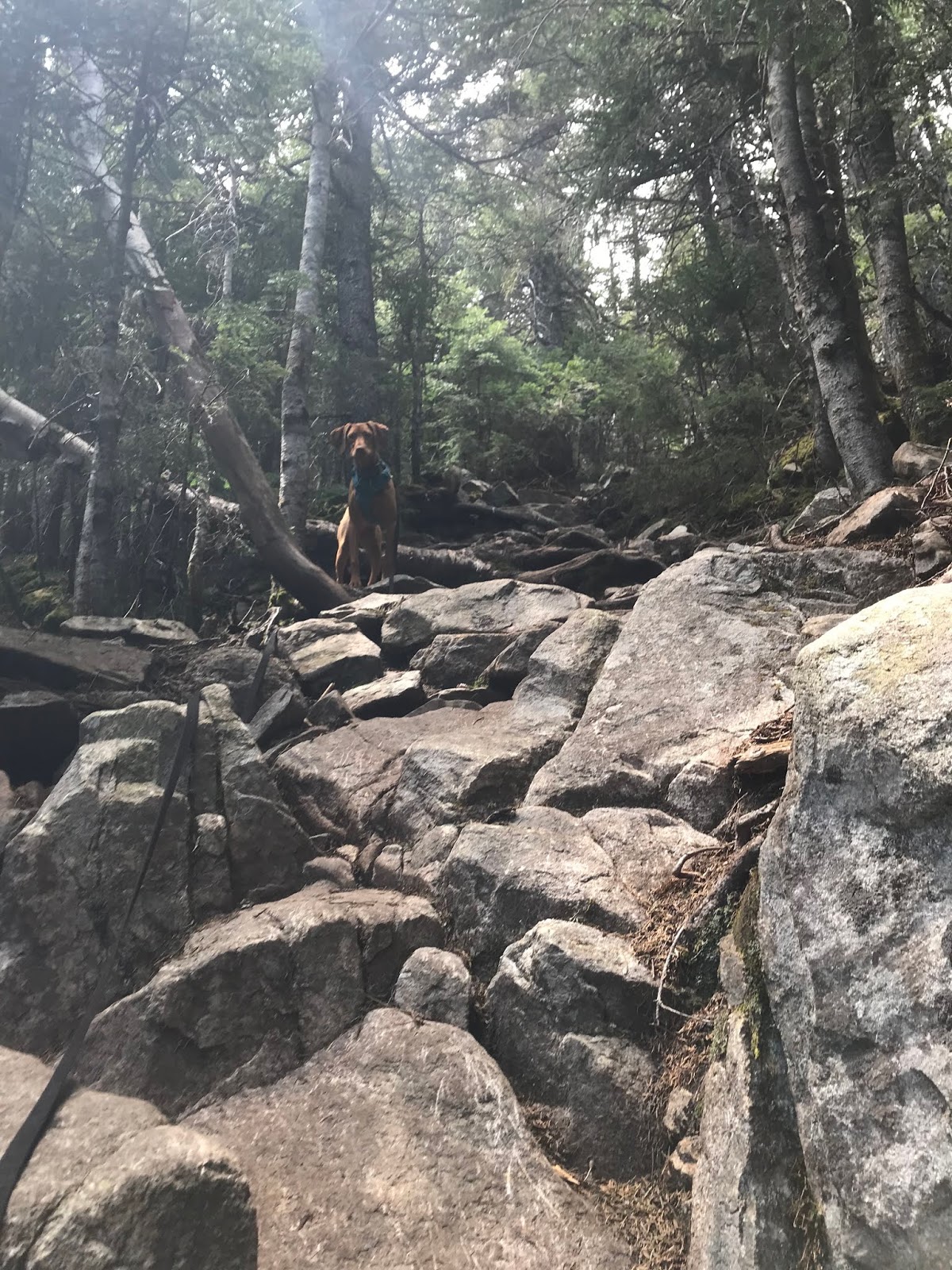
-Our dog was a rockstar, and did an amazing job (I can't think this trail would be a good choice for anything other than a brave and athletic canine)
-This is a trail that certainly would be quite dangerous in wet or icy conditions. Also, I would not be AT ALL excited to come down this stuff. 
-It's a long stretch. Over half a mile from what I could see- and possibly slightly more. 
-There are "bail out" (totally unmarked) options in the woods but they are TOUGH. Basically straight uphill, just grabbing trees. I took one of these for the sake of the dog, and it was fine but NOT easy. I would not take small children, timid dogs, or beginner hikers on this trail. 


The easy part....
In the end, we made it up without issue. I never felt terribly nervous, I just found that I had to pay attention and not be an idiot. 
After the slide finished, there was only a short distance (of mostly very uphill work) to the intersection with Franconia Ridge Trail. 
Ellie saw the peak (or close to it!) and sprinted up. 
I may not have been so quick to let her scramble up, had I known it was basically a cliff. 

Queen of Mt Flume
It was a MONEY DAY. Blue skies, light breeze, only a little haze. Definitely a day to be above the trees!

The "other side" of what Elle climbed up.....
After spending a few minutes on top the hill, we headed off to traverse to Liberty. The map said it would be about 1.5 miles to the next peak (watches measured closer to 1.1 miles- who knows what is right!)
Generally speaking, it was a pretty straightforward path through the woods.

Moseying along
Gotta get the photo op!
Pretty soon, there was a short and straightforward scramble, and we got a great view of where we had just been!

Hello, Flume
A few steps later, we summited Liberty. And it was glorious!!

Just me on a big rock
You could see for forever
We definitely dilly dallied for a while at the summit. It's not often that we score such a perfect day, and we wanted to make the most of it. Also, we wanted to give the dog a moment to eat and recharge (not that she needs it....)


Family Pic!!
After we enjoyed some time up high, we headed back down the mountain. A short stretch on Franconia Ridge took us to the junction with Liberty Springs Trail. The temptation to continue along the ridge was strong, but it would have meant too many miles for Mrs. Ellington.

Franconia Ridge, in the trees
Liberty Springs trail is one of those rocky pain in the butt experiences. It was a moderate to steep grade in places, and was just a bunch of rock hopping and stone stair stepping. Nothing extreme like the slide, but it would certainly give you a good workout in the uphill direction!

Looking up Liberty Springs Trail
The final mile or so of the trial is downright pleasant- and seemed to have tricked quite a few "family" hikers into thinking it would be a good summit to achieve with their VERY small children (in flip flops....) I mean.... Maybe? But my vote is no.
We took the required "sign" photo at the junction of Liberty Springs and Flume, and met up with another hiker who we had seen at the top of Flume. He had come own the slide and proclaimed it to be "the worst thing I have ever tried to do." Let that be a warning! Haha.
We then forged onwards, a trio now, and proceeded to take our own trail back to the bike path. The very well beaten path would make one thing that we were not the first adventurers to do such a thing.
Just make sure to take a left at the junction to stay on the*actual* trail!
(or go straight and you''ll still be ok! we figured there hadn't been to many blazes anyway, so why start looking for them now! and with the clear and obvious din of I-93 ahead of you- you're not getting lost.)

Obligatory sign pic
Anyway! After 6 hours and 2 minutes of hiking, snacking, photo taking, and playing in the river we made it back to the PACKED parking lot.
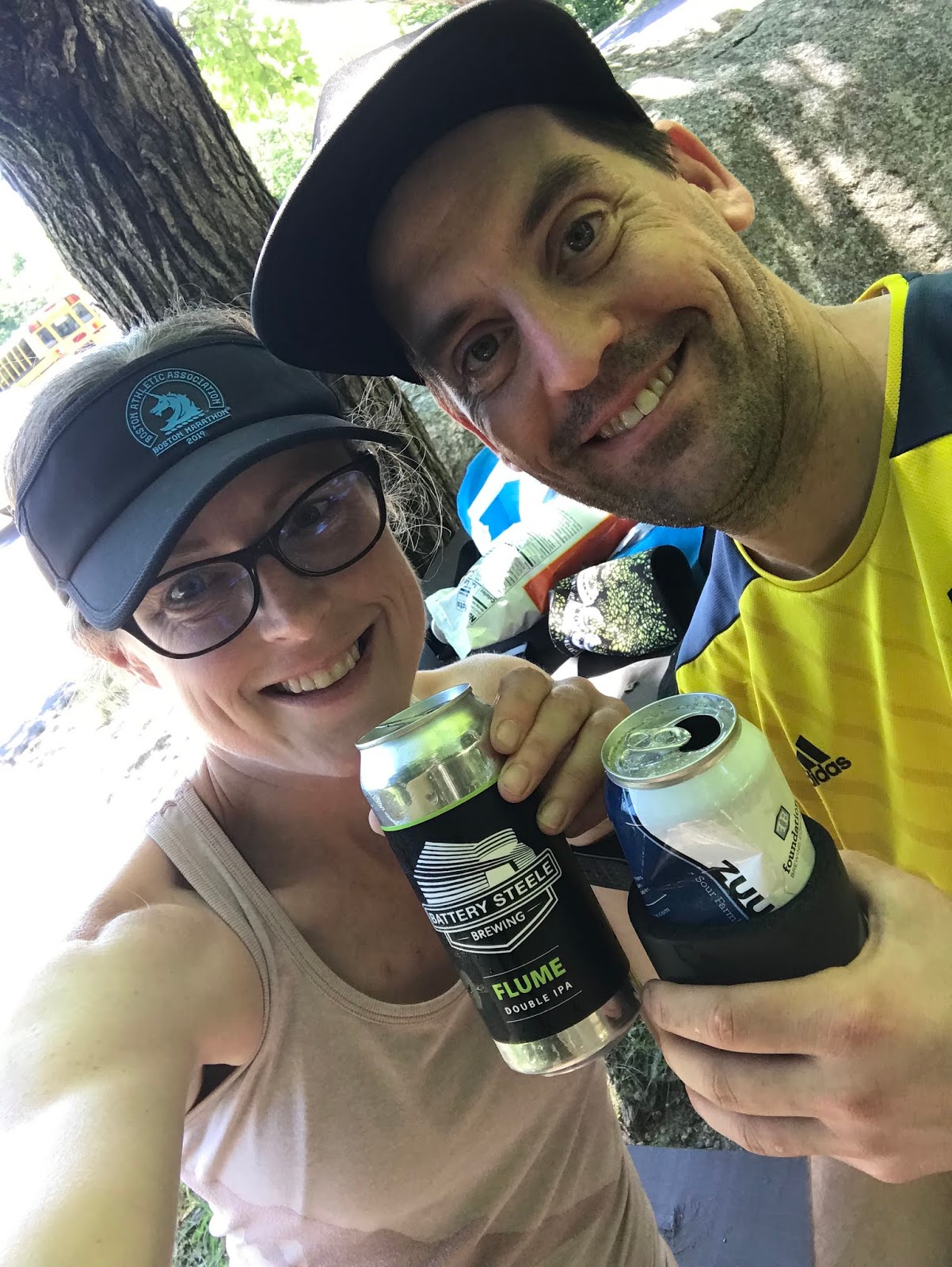
I managed to take a spectacular tumble while watching Ellie play in the river- but it was *technically* after the hike was over. So it was a "no fall" hike!!

I had a FLUME beer!!! How appropriate!!
We relaxed at a picnic table for a while, and were swiftly joined by an entire age group of summer campers. They had 4 million questions to ask us, and from me they learned what it means to Spay a dog, and how best to pee in the woods without being shy. I am very helpful.

Overall- this may have been the best hike of the season. It was a great length, a nice challenge, perfect weather, and low hiker traffic. It certainly is NOT a great hike for a first timer, but definitely one to put on the must do list. Probably a good choice for those days that the Franconia Ridge loop is just too busy to even cope with.


Strava data: (we take this with a grain of salt) 
-elevation climbed: 3,846
-miles covered: 9.8
-elapsed time: 6:02 (we never shut off our watches- so this includes all down time)

Difficulty: Strenuous. Coming in at around 10 miles, and dealing with the slide are what edges this out of my normal "hard" category. If you are looking for a beautiful, wooded and "easy" hike, hit up the bike path and the first couple miles of Flume Slide. While the slide does not take up the majority of the hikes that (plus the steed descent in places on Liberty Springs) would make this no fun for beginners. 

Views: Excellent and numerous. Impressive. 360 views from both peaks. 

Bugs: Black flies were out, and were mildly annoying

Dog friendly trail? Ish. Only for the brave and athletic friends. Lots of "water features" for the playful doggos, but the slide isn't something for every canine. 


Thursday, June 13, 2019

Mt Willey and Mt Field: 4k footers #8 & (repeat) 9 of 2019

Summer arrived.

The three of us headed off last Sunday to FINALLY conquer Willey after being thwarted by snow, and trail conditions several weeks ago.

It was a toasty day, well into the upper 70's and just as sunny as you could ask for. RARE.

We left the Willey House (a fascinating historical landmark) exactly at 12:00 and headed up the Kedron Flume trail.

Warm day, no snow
We have discovered that Ellie has developed a real obsession with running water, and she happily played in the flume, much to our amusement.

Vizsla Butt
(it's about a .80 mile hike to the flume- great for kids or people who love a pretty falls.)

The day was beautiful, and the views were good right from the get go.

Always nice to see a view!
After the falls, the trail (Ethan Pond to Willey Range Trail) was in super condition. No snow, very little mud, easy stream crossings. The trail might have been low on blazes in a couple places, but it was extremely obvious that you were on the trail.


It is only 2.5-ish miles to the top of Willey, so you gain some serious elevation. Lots of it is pretty low key and non technical, but definitely UP.

Like up the helpful stairs
The steep sections were broken up by some easy places, which made the hike very manageable. I would say that this should not be someones first 4k footer, but it's a good one (and a pretty short one) to work towards.
We had heard/read a lot about the ladder/stair section and had some concerns that Ellie would have issues. It was a little intense, but dry so we all managed well. If you had a timid dog, they could certainly be an issue.

The first of about 8 or so stair/ladders
After the ladders, there was more UP, and some rocky stretches.

Nothing major, but definitely not a dirt trail
Right at mile 2.5 we summited. The actual summit was ANOTHER low fanfare cairn, but there were a number of scenic vistas that were very impressive. Definitely a good reward for the elevation gain!

Really lovely

A perfect day
We spent a moment in contemplation at the summit. Retrace our steps, or continue to Field, finish at Crawford Depot, and try to find a ride back to Willey House.
The good weather, and the first good trail conditions of the year pushed us towards Field. Knowing we were only adding a mile or so to our plan, we headed off.
And quickly found snow (which was totally minor, but funny to see!)

Evan would have postholed!!
Clearly, the trail between Willey and Field has dried up, and been cleaned up considerably since our last attempt. Lots of evidence of recent blowdowns being cleared, which left the trail in great shape.

I'm such a super fan of beautiful trails like this
We came across a spot where it appears some awful weather happened at some point in the past. It's not easy being trees in the Whites.

Sorry trees
It really was a great walk between the two mountains, and one that we enjoyed all the more without the snow! Before long we were on Mt Field, and appreciated how pleasant it was without 4 feet of snow upon it!

About 40 degrees warmer than last time
Very Pretty
The hike down Avalon was uneventful an quiet. We saw a grand total of maybe 3 people. We agreed, that in conditions as good as we found on this day the trifecta of Tom, Field, and Willey would be completely manageable. My suggestion, if you plan to traverse and not do an out and back, start at the Willey side. (I'm a fan of taking the hard path up and easy path down- and between the ladders and the steep rocks, Willey is the harder ascent in my belief.)

Anywhoo. We made it down!!! YAY!! Ellie enjoyed playing in all the streams on Avalon, and was basically a big goofball every time she heard water.

Why the long face, Elle?
We got super lucky and immediately scored a ride back to the Willey House with a super nice woman from Mass, who was enjoying a camping weekend. Really good timing, and much appreciated on our part!! It was a big enough/fast enough/hot enough hike to have all 3 of us feeling a little tired, so we were glad not to have to walk 2.5 miles on 302 back to the car.

We got back and had a parking lot party. Basically everyone driving past us gave us a honk, because we are awesome.

Or because we have a very cute pupkins
So final thoughts. Willey is another 4k footer off "the list" for us, and it was vigorous but manageable. Short and steep. Great views, fun water crossings, a few unique challenges like the ladders. It was another 99.9% below treeline hike, but that makes it a decent choice for a foggy day when you don't want to die on Mt. Madison.

Strava data: (we take this with a grain of salt) 
-elevation climbed: 3,494
-miles covered: 6.5
-elapsed time: 4:20- plenty of water play time for the kid. 

Difficulty: Moderate due to steep sections, ladders, some rocks. Safe because below treeline and not too terribly long. 

Views: Quite good, several chances to enjoy the scenery. 

Bugs: Black flies were out, but we mostly avoided them

Dog friendly trail? Yes, but you do have several stream crossings, a few steep and rocky stretches and the series of stair/ladders. While Ellie had no issue, there is NO way that out Lab could have managed this trail. So proceed with caution. 


Signature