Showing posts with label 4k footers. Show all posts

Friday, August 30, 2019

Isolation! August 25, 2019

The night before this hike, we had decide not to attempt Isolation. The Saturday weather had not been as good as forecasted, we were a bit tired from Zealand: the extended version. And REALLY, who wants to get up at ass o'clock every day??

So, when Eric got out of the tent at 6:45 on Sunday morning and said "SHIT. We need to hit Isolation today!" I was both excited, and freaked out because one would have planned on an earlier start.

But yes, the sun was shining gloriously and there was not a doubt in our collective minds. It was a day for some above treeline nonsense.

We managed to get on trail exactly 9:30- which is a hideously late start. Thankfully, sunset is still on the later side so were not too worried. I had heard wildly varying times for this hike but calculated that we should/could be able to do it in 8.5.

And off we went.

Not too gross after a couple days in a tent
We chose the Glen Boulder trail to start with, and it gains some serious elevation right from the beginning. However, it tosses in some switchbacks, and moderate sections (so as long as you don't go out habanero- you will make it. We certainly saw some humans around mile .75 who were DONE for the day. Don't be those guys.)

Just normal up and up
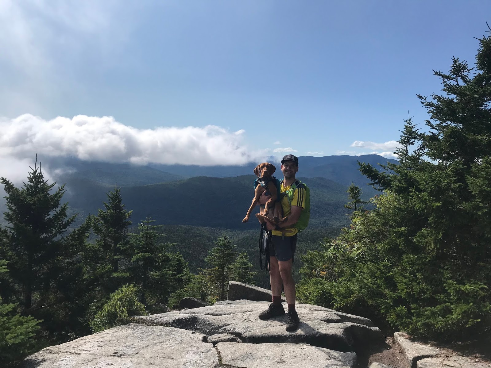
As the trail pops above the treeline for the first time, there is the only technical scramble of the day. Our typically fearless dog took a good look at this little rock slab and asked for a boost. She was then on her way and had no other issues (this is just good to keep in mind if you have a cautious/old/arthritic/non-athletic dog. they might not make it up this.)

The view looking towards Glen Boulder was stunning. It was a perfect weather day, in beautiful surroundings.

Just a small rock on a hill 

It's kind of amazing that such a large rock decided to settle in this exact place. Let's hope it stays put.

Ellie is like, 50 feet away for perspective
After checking out the boulder, we continued to go up. A stretch of above treeline hiking, then  transitioned into some more wooded path.
There is a spring off this stretch of trail: be aware, this is the only easy place to get water for the remainder of the hike. If you have a dog, make sure to bring a LOT of water!

On the way to the intersection of Glen Boulder Trail, and Davis Path, you pass over a summit which is called Slide Peak, or Gulf Peak depending on what map you look at. While it is right at 4800 feet, it doesn't "count" because it doesn't have prominence. BUT- it has some killer views.

Right at about 5100 feet, 3.2 miles in, you come to the intersection with Davis, and make the left turn towards Isolation. (by the way, this was Ellie's highest climb!)
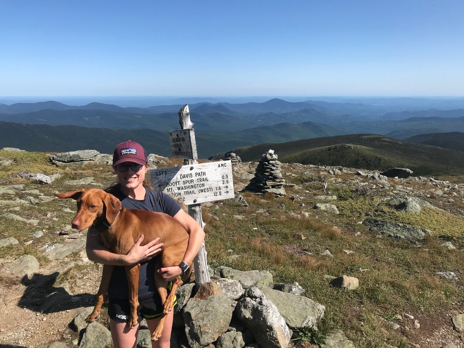
Can't beat the weather, or the view!
And then. YOU GO DOWN.
Might as well enjoy it though. The sights just don't get any more gorgeous.

Isolation, here we come
The little above treeline stretch was just glorious, but luckily, we both really liked the wooded sections too. You really drop like a rock, losing over 1k elevation pretty damn quick. You're going to hoof along in the woods for about 2 miles- and they aren't bad miles at all!! Then, you'll come to a fork in the road and take the right hand trail towards Isolation. Only another 0.9 to go at that point...!

A pleasant trail!
There are some pretty muddy areas on the Isolation trail, and I imagine it is a gross mess in the Spring. But I didn't take any pics that weren't pretty, haha.

And just like that (well. after almost 4 hours) there is was!

Yay!
Just a small climb and POP, above treeline you go.
To some of the best views you can hope for.

BEST VIEW
Just kidding. It was lovely.

Gotta get back up that, though
We could not have asked for better conditions. Save this one for a glorious day!

We made it!
We made it to the summit in almost exactly 4 hours. We did have to stop several times to water and feed the dog, and for minor outfit changes. Nothing major though.

After enjoying about 10-15 minutes at the summit, we were off again. Knowing we had a pretty solid climb in the way down was a good motivator not to dilly-dally.

The return trip was, honestly (and thankfully!) uneventful. Yes, there was a climb to get back to Glen Boulder trail. But: it was such a nice day, the surroundings were so fabulous, and we are in decent shape, so it was not at all horrible.
We retraced our steps, as I have heard that Rocky Branch is not in good shape. Plus, we don't always trust our hitchhiking skills.

BACK UP WE GO!
Gotta take a few to check out the view.

Just out of the tiny woods
Shadows were beginning to fall by the time we made it back to the big big rock.

Casts a large shadow
It was a good walk down. We had braced ourselves for being really tired, which never actually came to pass. We braced ourselves for some level of frustration, which also never happened! The dog got a little crazy at the end, but saved it for the final stretch so that wasn't even an issue. We had prepared for a real level of struggle (especially after hiking 12 plus the prior day) but it never was that bad. We had some good laughs on the way down, the trail is impeccably marked so we never had the "oh shit where do we go" feeling, like we had on the Twins, and it was a fine ending to a truly fine hike!

Elle is so embarrassed 
This was a great one.
Don't do it if you aren't in shape.
(good to note: there really is not a "bail out" option on this hike. so if you can tell it is not your day, head down earlier rather than later.)
Save it for a nice day!
AND ENJOY.
Also, this brought us up to #28 on the NH48 list (I believe, the 21st one we have done in 2019!!)  I really have to appreciate the list for being a motivator to get out and do a hike like this. Otherwise, I might have said "11.6 miles for a little mountain?!? NO WAY!!" And thus, would have missed out on a really fun day.


Strava data: (we take this with a grain of salt) 
-elevation climbed: 5,007 (HELLO!!!!)
-miles covered: 11.6
-elapsed time: 7:58

Difficulty: Strenuous. Very long, lots of vert. But amazing!!!! Very exposed in places, not a great option for a bad weather day. This route avoids major water crossings, but it can certainly get very muddy. You are, indeed, isolated out there. No viable bail out routes that would help you in a bad situation, so you must be smart to do this one. I did find some cell service in a few places, but it's very spotty. 

Views: Unbeatable. Even if you only go to Glen Boulder. 

Bugs: Nope

Dog friendly trail? Ish. One tricky scramble, and very long with very little water. Our little buddy loved it, but she's nuts. 

Signature

Wednesday, August 28, 2019

Zealand: The extended version. August 24, 2019

Eric, Ellie and I went camping over the weekend.
Since we were already ON the Zealand Road, we concluded that it only made sense to hike Zealand.

It seems to be a little talked about Mountain- people seem to tie it in with Hale (smart) or snag it during an extended Pemi (less smart??)

We got up, the weather was decent enough (cold!) we drove a couple miles up the Zealand road to the Zealand Trail lot ($5, packed, typical) We parked in the Zealand lot which connects to the Zealand trail and takes you to the Zealand hut and Mt. Zealand, BECAUSE EVERYTHING AROUND HERE IS CALLED ZEALAND! I think this is very amusing.

And we made a STARTLING DISCOVERY!!!!!


OH MY GOD?!?!?! IT IS??? 
I admit, the Thoreau Bridge closed signs are mostly a joke between Eric and me (and maybe not even a funny one...) But Eric and I find it very amusing, every time we come to a bridge, to politely ask one another if it is the Thoreau Bridge. And then shout "IT IS OUTTTTT!"
We think we are funny.

Anyway. It was like 45 degrees and off we went. 
Zealand Trail was very polite.

Yes please
THEN. Zealand Trail went through a swamp, and I LOVE SWAMPS!!!

Thoreau bridge!!!! Nope...
OMG stop. I love it.

It was a bit cloudy though to be honest. 
Anyway. We chugged along on the flatlands for a few legit miles, and then the trail turned upward by Zealand Falls, and headed to the hut. The trail to the hut which covers 2.8 miles, literally goes up 700 something feet. It is the least hard thing you will do all summer.

The only steep stretch in the first part
After passing by the hut you transition to the Twinway (the AT) which continues to be very reasonable, although somewhat more uphill. You pass over some little flumes, along some pretty rocks and through a lovely forest.
There is a viewpoint just before the Zeacliff trail that should not be passed by! This is right around 3.7 miles, by a sign that says "view". The sign is correct.
From what I understand, this is "Zeacliff" which makes sense, as it is a cliff. This is a tad confusing, since on the actual Zeacliff trail is another perfectly good Zeacliff. who knows.

Beautiful!!!
From there, the trail continued to be so enjoyable! Well marked, so obvious, perfectly maintained. Just delightful.

Doesn't get much better!
There were, as expected, a few uphill stretches but they were broken up perfectly by easier terrain. There were a couple (few) rock hops, the smallest of teeny baby scrambles, and one steeper section with a very doable little climb, and helpful ladder.

Mostly though, it was fun and straightforward.

Ellie approved
And soon: there we were!

YAY!
A pretty low key peak.

Another one in the books
We met several very friendly and interesting hikers at the top, and spent a while talking about our shared  experiences. We were in no rush on this particular day and thus, spent a decent amount of time talking to fellow hikers.

Now one might think that the best choice for the return trip would be the same sensible, enjoyable, easy to follow, pristine trail that we had just taken.

But no. We wanted a view, and some rugged, wild, messy wilderness.
So we took Zeacliff....

It did not disappoint!!

On a cliff. ANOTHER ZEACLIFF WHAT THE HELL. 
In stark contrast to the friendly for all, almost Disneyesque features of Zealand Trail and Twinway, Zeacliff was a wild little adventure. Plummeting into a valley that leaves you staring into the face of whitewall, there is little question that you are taking the path less traveled.

Jurassic Park??
The trail is mostly easy follow but infrequent blazes should merit some caution. The trail is plenty full of adventure- and would be a cardio nightmare to ascend!

After plummeting into the lowest point on the planet, you go up a bit (steeply) cross a river, and come face to face with Whitewall Mountain (which I did NOT want to go up!)

Straight UP
After a bit of "find the cairn" and some rock-hoppity crap:

Rock Hoppity CRAP
...we ended up securely, as planned, on Ethan Pond Trail (actually passing by Thoreau Springs trail- don't tempt us to find the bridge vacancy!!!)

Ethan Pond trail brought us back to a very practical place on a totally sensible path. Very pleasant.

Very nice. 
Back to Zealand trail, back through the glorious swamp, and back to the campsite!!!!

Fun!!!
This was a very enjoyable day. What a great hike!
While I hesitate to call any double digit hike "moderate" this is what a moderate long hike looks like, in my opinion. (probably a great idea to tag Zealand and Hale- another hill I like- together. But I'm actually pretty happy that we did them separately! They can be enjoyed in their own right!)
For the easy route, skip Zeacliff (the trail. not the scenic viewpoint. I know..... ) We had the time/fitness and it was fun. I imagine going up is good workout, and going down could be a bit gross if things are wet. Be mindful of where the trail is in the overgrown places!!


Strava data: (we take this with a grain of salt) 
-elevation climbed: 2,867 (not at all bad for so many miles!)
-miles covered: 12.6
-elapsed time: 6:47- includes all time chit chatting 

Difficulty: Moderate. But only if you skip Zeacliff and the extra mileage 

Views: Nothing from the summit (people hate this!) but a GREAT viewpoint 

Bugs: They seem to be gone

Dog friendly trail? Stick to the basic route- VERY dog friendly! Zeacliff has a pretty good sized slab/scramble/climb which, while very short, could be a pretty big question for most dogs. 


Signature

Tuesday, August 27, 2019

The Twins: August 11, 2019

After tackling the Cats the previous day, the three of us hit the road again to take on the Twins.

We had a pretty good plan, to meet up with Eric's sister on North Twin, hit the South peak as a group, crack some champagne to celebrate her birthday (while bathed in sun, and while enjoying the stunning views!!) Solid plan. Off we went.

It was a chilly morning, but the sun was peeking out. The (free) lot was full at the base of North Twin trail, and we were about the 10th car on the road at 7:45 AM. Busy day.

Upsettingly, it seems the Thoreau bridge is OUT. Who knew?

WHO KNEW?
The trail started off pleasantly- and actually continued to be really nice and flat for almost 3 miles.

Off we go on a nice flat path!!
There are several river crossings, most of which are very poorly marked.

One of several crossings
Overall- this trail is not always the best marked, PERIOD.  Luckily, after a few steps on a perfectly decent washout you can usually sort things out (on the uphill stretch anyway.) There are many moments where it is very apparent that people took the wrong route- so you really need to have your eyes open.
The second river crossing on ascent is a problem- the trail confidently veers off to follow some blue surveyors tape hanging from trees. Luckily, I had just read someone's trail repost that mentioned that following this tape takes you the incorrect way.
*from what I understand, there is a bushwack that meanders along the river for about a mile. I'm really a fan of the actual trail, so while I sure this is totally valid info, I only bushwack when it is absolutely necessary.*
On decent- it is the final river (so, third) crossing that will get you. And the vast majority of your friends, from the looks of the trail. Go left. That's all.
I imagine these rivers would be significant in the Spring, or during a wet summer. On this particular day, they were very rock hoppable.

ANYWAY.
Around mile 3, the trail began to go up.

Just a normal up though
The ascent is not the madness of the Hancocks, where you mosey along a flat path for miles and then go STRAIGHT UP LIKE HAND OVER DAMN FIST. But the final two miles certainly gains some elevation.

Eric and I were not offended by the terrain, although both of us felt a bit less than fresh after getting beat up on the friggin Cats the previous day. Everything on this mountain is doable though, and would be downright pleasant on a pair of new legs.

The weather began to get pretty cold, windy and crappy as we neared the summit. This was a bit of a bummer- the second socked in day in a row. UGH!!

We popped above treeline, to a place where the obviously is a great view on a nice day. Evidently, when it is clear one can see Garfield, Lafayette, and the summit of South Twin easily.
On this day we saw nothing.

AMAZING!!!!!!!
However, steps later we did see Eric's sister Jyoti, and her friend Mia, who had made it to the Summit of North Twin, just a short distance away. Since the weather was crap, they decided to save South for another day. Wise, wise women. We gave them some tiny bottles of champagne to enjoy at home, and completely forgot to take a photo. BOOOO.

So, on we hustled to the actual summit. It was a great little path.

I love tiny trees
Actual Summit
Then, we continued on another 1.3 miles to towards the South peak.
It was a very pleasant walk, in trees and ferns and greenery. There was one somewhat rocky section, which I hesitate to call a scramble, because it was really very minor. Overall, we really enjoyed this section of the hike. (there were a few places where we had to hip-hop over some mud- but it was not catastrophic!)

And then, the second summit.

Ellie is zero percent amused
Evidently, on a nice day, one would have an amazing view of Guyot, the Bonds, and a great deal of the Pemi wilderness. On this day.... just a cloud.
Can't win them all.
It wasn't nice out so we got back on trail quickly.

Down into the tiny trees

Ellie and I love the tiny tree forest!!!!!
The walk down was generally uneventful. Steep enough in places to merit attention, but nothing disgustingly challenging.
At one point, we almost got a view!

We'll take it!!!
By the time we got to the flat section, we were all feeling a bit overcooked (we blame wildcat D)
At the final river crossing we were honestly irritated by the unclear trail. While it was so minor in the big picture (we have a map, there was plenty of daylight, we are prepared) it was VERY annoying at the time to feel disoriented. Just a good reminder to always have a map, and that every trail is not as clear as one might wish for.

We made it down, to find warm, warm sunshine......

Overdone Bradlowski Family
We were a bit wrecked. My ankles and left shin had been taking a beating all summer, and this was the final straw. This was really a perfectly enjoyable hike, but the whole group of us were feeling crabby.  So we had a beer and got over it. A tough weekend hiking is still a better weekend than most people get to have!!

Why is it so nice out now?!?
So, the moral of this story is that North and South Twin are not bad mountains at all. Mind the path, and know it is going to eventually get steep (and pick a sunny day) and you'll really love it.
It's a long one, and I would never suggest a high mileage hike for a first attempt at a 4k footer. It is easier than the Hancock's and MUCH easier than the stupid face Wildcat range. (still mad, haha.) I have a feeling that the views are probably outstanding on a good day-this might be one that we choose to do again.

Strava data: (we take this with a grain of salt) 
-elevation climbed: 3,744
-miles covered: 11.4
-elapsed time: 6:45

Difficulty: Difficult. It is long, there certainly is some incline to deal with, and I imagine the river crossings are challenging/impossible in high water season. 

Views: Tough to know

Bugs: Nope

Dog friendly trail? Yes. 


Signature

Wednesday, August 14, 2019

Wildcat D through A: August 10 2019

All season we have had good weather. And we were promised more for this past weekend. With MUCH DELIGHT we eagerly planned to get to Isolation on Saturday, with more to come on Sunday. Very excited, we love the lovely sunny weather in the 70's, and 60's up on the hill.

BUT NO, THAT IS NOT WHAT HAPPENED.

Saturday morning, 5 AM, RAINING. The mountain forecast suddenly looked piss poor, with high winds coming off Washington, rain, and pop up Thunder.
Well, that sounded excellent. NOT.

So, plan B. Hit the Cats and check them off the list. Below treeline, much safer, trail options, etc. So off went.

We parked at the $5 Glen Ellis Falls Lot, on Route 16 just after the Pinkham Notch Visitors Center. At 7:30, it was virtually empty (at 2:30, completely full.)

The weather was crabby. Low, dark clouds. Very cool (in the 50's) and you could hear the wind on the Washington side of the road. Fun, fun.
So, as we went through the tunnel that takes you under Rt 16, and we crossed the (very low) Ellis River, we felt we had made a good choice to pass on Isolation. There's always a better day for above treeline nonsense.

Anyway. Up Wildcat Ridge Trail we went.
And yes, I mean UP. Jesus H.

First you up some normal rocks

Then some bigger rocks

Quickly, you get your first view (Washington is socked in)
Anyway. You go up more
You come to another place to see Washington in the clouds

Alternate View
And just for fun, you go up MORE!!!!
And eventually, 2 miles in, you come to Wildcat D (which is a peak with a viewing area, just past the gondola)

Hey, we can see a little something which is good!!
So the two miles of Wildcat Ridge trail to the D peak are no joke. I feel like the Cats are the peaks nobody bothers talking about, as everyone is bagging and tagging the presis, or more interesting peaks. Let me warn you, this is NOT the trail to do for your first 4k footer!!!
The good thing about the trail?
-never a dull moment
-not many other hikers
-well marked!!!
-good exercise
-a good ass kicking
-when it is over

I mean, you basically gain 2k elevation in the first two miles. So use that as your cautionary tale.

So from there, more Wildcat Ridge Trail to the A summit.
Of course, there are quite a few ups and downs, as one must deal with Summits B and C.


Onward!!! Into the rain!!!

 It is about 2 miles in between summits and continues to be NOT dull. Plus, it kept raining. It happens, but it is dumb.

Thrilled
We found the very casual peak of Wildcat A, tucked amongst some trees.

Hi
For a hot minute, the sun came out and we almost had a view of the Carters!!!

A really nice moment!!!!

 However... soon enough we were back into the trees and back into the rain.

Gloom
We didn't like the sound of descending the two miles from peak D to the lot.
Luckily, there is an option.

YAYYY Take the gondola down!!!! JK. We did not. Also- those clouds? THUNDER.
But you CAN take these trails down, and you can also take them up (and YES, it does COUNT!) If you want to cut about 90% of the crap out of the cats, just take the ski trail. It is wicked boring, but wicked safe (and since I have my eye on redlining, I'm glad we took the Ridge trail. but only for that reason, haha!!)

God damn super highway

Love the lovely ski trail
 Just when we thought we were in the clear, we heard a HUGE RUMBLE OF THUNDER.
SHIT.
We looked at one another. "LET'S RUN" we cried! As we dashed madly down the mountain. Just in the nick of time we made it to the ski lodge, and took cover for 20 or so minutes while the skies opened up.
There was no way we were getting a ride back to the car on this particular day (grouchy looking tourists with tantrum children do not want to give hikers a lift!) So we hoofed it back down death trap route 16.

Luckily, at Pinkham one is able to connect to the Lost Pond trail (which is kind of a disaster after the first little stretch.) Regardless, nobody should walk on Rt 16.

On cue, the sun came out. 
About a mile or so of walking, and we made it back.

DONE
Don't let the sunny pic fool you. It was still raining!!!! Ridiculous!

Absolutely the most challenging hike of the season. You legit need some miles under your belt before attempting this trail (or, take the ski trail. this really eliminates much/most of the hardship!!)
A crummy weather day in the mountains is still a good day, so despite all my bitching I still had a nice time with my lovely husband, and terrific dog (who loved her day!!)

Plus, this checked #23 and #24 off the list. Officially half way there!!!

Strava data: (we take this with a grain of salt) 
-elevation climbed: 3,826
-miles covered: 10.5
-elapsed time: 6:51

Difficulty: Strenuous. Certainly a trail that will wear you right out. However, my belief is if one was to stick to the ski trail this would rank as moderate. 

Views: Several spots within the first mile, nice view of Washington from the ski trails, and the observation deck. And a good look at the Carters from the A peak view point. 

Bugs: Nope

Dog friendly trail? Ish. Our dog loved it but she cray. Awfully steep at times, could be tough for a wimpy canine friend. 

Signature