Last week, in a completely whirlwind (and completely fun) 48 hour trip, Eric, Lee, Evan and I climbed Katahdin.
 |
| Yes, yes we did |
Now, growing up with Lee (the hiking master) I know that I should be specific, and state that we summited Baxter peak. I grew up in Maine (with a hiking family, obvs) so I understand the layout of Katahdin. There is the highest peak, Baxter, which is famous for being the Northern Terminus of the Appalachian Trail.
 |
| The sign agrees |
Katahdin has several sub-peaks, South Peak, Pamola, Chimney Peak, Hamlin Peak, and South/North Howe Peaks. (I have literally never met a person who has mentioned any peak other than Pamola and Baxter. But they, evidently, exist.)
Either way. We summited Baxter Peak via Hunt Trail, which is the final stretch of the AT.
We chose this route based on the convenience of the trailhead location, as we were luckily able to snag an amazing lean to at Katahdin Springs Campground. (mid week plans, for the win!) We were in camp site 12, and literally walked out the door and were at the trail head.
Katahdin was not on my radar earlier in the season, as the thought of camping makes me cringe. (and it's just not a day trip from where we live) As my hiking bug grew, and ridiculous adventures seemed more sensible, I decided to bite the bullet and take the plunge (I'm going to write a separate post on the fantasticness of this camping experience, and why I quit camping to begin with 30 years ago.)
(but this post is about the hike)
After a good nights sleep, we were all up and ready to hit the trail at 7:15. The weather simply could not have been better, which is the most remarkable part of this trip. (except the part where I slept outdoors, of my own volition.)
The weather was brisk (which prompted all of us to pack like it was going to be a Mt Washington wind/fog/death march) but the chilly start was just there to wake us up for a DAMN NICE DAY!
 |
| Slightly chilly at the start, and almost awake |
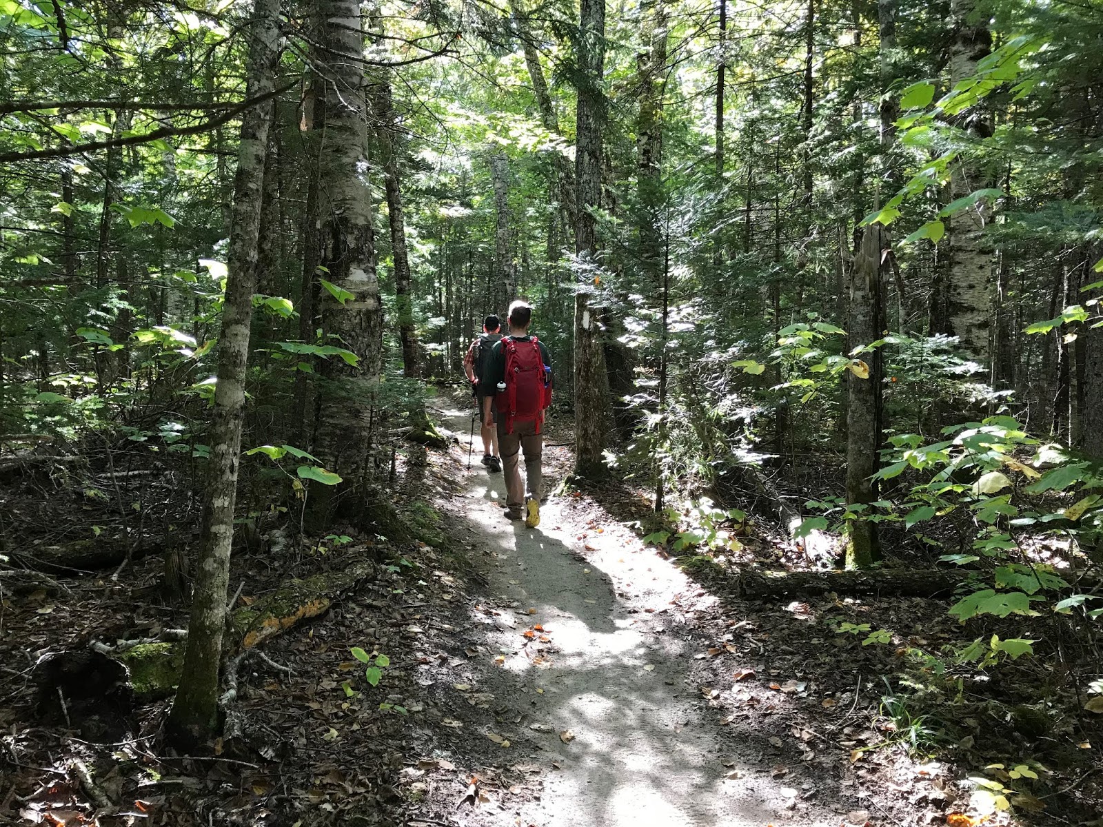
The first mile, or so, of the trail was amazingly pleasant.
 |
| Perfect trail, and the best hiking friends! |
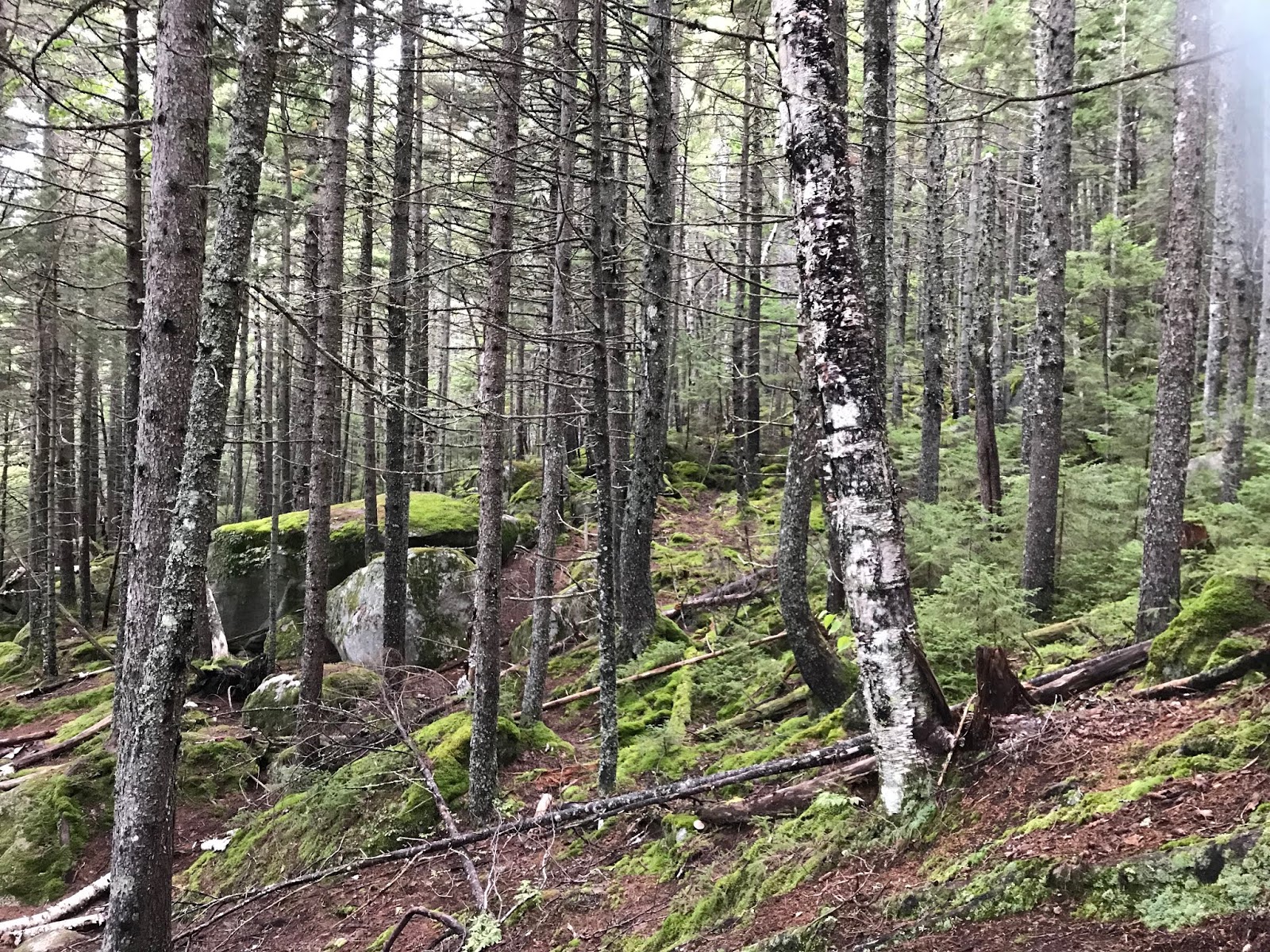
We walked through the Narnia Forest (fun fact: this part of Baxter State Park was the inspiration for the forest in the Disney movie Bambi!)
 |
| Where are you, Bambi?? |
The terrain was a mixture of so-easy that your Grandma could do it, and occasional roots and rocks, and the classic bridge crossing.
 |
| Warmer. Enjoying the oh so rustic bridge. |
Right around mile one was Katahdin Stream Falls, which wins "best waterfall" for 2018.
 |
| Perfect |
After the falls, the trail began to get more challenging. (so... leave Grandma at the falls!)
We trundled uphill for a while, and while there was the occasional rocky jump, or mysterious trail stream, I found this section to be more forgiving than most of the ascents on the White Mountains that we have accomplished this year.
 |
| Stone stairs are forgiving compared to some climbs |
But don't worry, it was not just a casual walk up a bunch of stairs.
 |
| Just some rocks |
But you also get great views, really quickly.
 |
| Double Top, wayyyy over there |
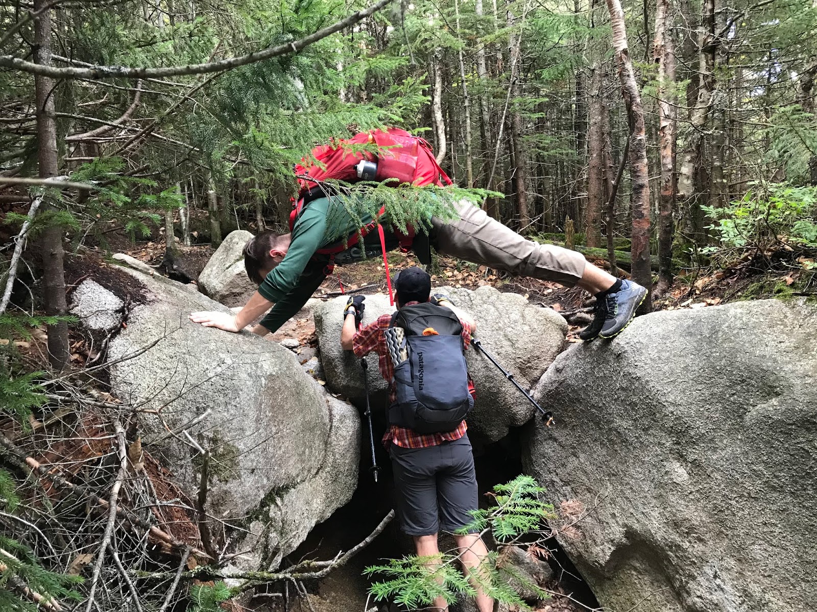
Plus, when there are super big rocks, we always make use of them #dorks
 |
| So fit. This is now a hiking tradition for these two. Now figure up how to climb up THERE. |
We were lucky to get an amazing view of the Owl from a terrific vantage point (basically, a giant boulder. this scenic overlook has a name which I just can not recall at the moment.)
 |
| Hello, Owl |
Very shortly after that point, things became serious. (as in: if the weather is bad, or you are unprepared, if you are already feeling fatigue, if you aren't up for a serious scramble TURN AROUND!)
We encountered a series of giant rocks, and the trail turned away from hiking, and into scrambling/light bouldering pretty damn quickly. Apparently, this is the beginning of the Hunt Spur. It's quite full of gigantic stones.
 |
| Yes, you need to climb up that!! |
Through this segment of trail, you will encounter some very *tight fit* spaces, which could challenge a human with a large pack (or a human who has very broad shoulders.) You must scramble up some very steep sections, some of which are equipped with iron bars.
 |
| Good luck scrambling up to that iron towel hanger.... |
From ahead of us we heard Evan say "wow... that was pretty intense...." And if HE thinks that the actual, blazed route is intense. IT IS.
After clambering through the giant boulders, we came across a perfect and GOD DAMNED MAGICAL plateau to have lunch upon. And it was just amazing.
 |
| JUST. GORGEOUS. |
The hike could have ended here, and we all would have felt satisfied (sort of)
We encountered some through hikers, and it was really cool to talk to them about their experiences, and how they were feeling with only a few miles to go. Hiking the AT is pretty impressive (and pretty luxurious if you want an unpopular opinion! but hey, being able to take 6 months off for hiking is pretty boujee if you ask me!)
So after hanging out in friggin heaven for a while having lunch, off we went.
Where were we going????
 |
| WHERE?? UP!!!! |
We were going to tackle the
remainder of the Hunt Spur. Thought you were done?? Nope!
 |
| OH HI (and that is NOT the top) |
This section of trail should not be taken lightly, but I found it easier on the uphill route than I had the iron-bar-boulder section. I have since heard tales of people getting panicked from the heights on this part of the spur, and hitting the bail out button.
 |
| Just the beginning.... |
PLEASE PLEASE DO NOT LET YOUR GRANDMA DO THIS.
But Lee is fine, FYI.
 |
| Lee doesn't give AF |
I think it goes without saying, but I would NEVER suggest doing this trip on a rainy/low vis day. Way too many possibilities for disaster.
But honestly, I had zero issues with the "up" section of the spur.
And neither did Evan..... (or any of us, but he climbs things)
 |
| "Evan... Don't make me call your mother!!" |
The final push up the spur is called the gateway.
BECAUSE IT IS A GATEWAY TO A MAGICAL PINK GRANITE WORLD!!!
 |
| Holy shit. Where are we??? |
We paused to regroup (it literally goes from this ass kicking climbing to a flat, sunny, grassy, gorgeous landscape.) Just unreal.
While we took our moment, we got to talk to more through hikers! Seriously, this was so fun. Some of them smell terrible (causing us to give them trail names like "toe cheese"and "swamp ass") but most of them were really fun and funny, and not smelly at all, and they all sit around looking hungry and chain smoking. (go figure)
And then we were off through the Table Land of magic, towards the summit.
 |
| Basically another planet. Amazing. |
We came across the famed Thoreau Springs, and Lee said it was the most watery that he has ever seen it. Apparently, it usually looks like someone peed on the ground. On this day, it was basically a small brook!
 |
| Quality photo... |
Walking across the Table Land was like nothing I have experienced. It was warm and dry, for starters, but it was also PINK! Small planes circled the summit frequently, which lessened the feeling that we were actually on another planet (seriously, it was so cool. such an amazing place to experience!)
 |
| And yes, I saw a crow in the distance. |
And what weather! As clear as we have seen, 60, dry and perfect. We were all so happy!
 |
| Selfie time! |
From the gateway to the summit it was probably close to a mile, but it seemed shorter because quite a bit was flat. There was a final, moderate 300ish ft climb to the peak, and just like that... We were there.
 |
| Amazing |
 |
| Please don't fall |
 |
| We made it! |
After spending some time at the summit, watching terrified looking hikers finish the Knife Edge (I think I'll tackle it someday. But NOT now) and taking in the sights, we headed down.
While we certainly set a blistering pace on the Table Land, the Spur really set all of us back a bit (especially me.)
 |
| Gotta go down this mess |
Apparently, on the way up I simply had not noticed the narrow passage way, or incline that we were traveling at.
I noticed on the descent. (pro tip: just don't look down.... or think too much.)
 |
| An easy section.... |
Honestly, after getting through the shit show upper spur, the iron bar section was a breeze. For all of us, it was much easier on the way down. I took alternate routes, which required some leaping, but were not terribly challenging.
Somehow, none of us wiped out. We laughed a LOT (over the most ridiculous things that I wish I could remember now!)
We kind of blazed through the descent. Food and beer were calling.
 |
| Back to the flat lands |
Before long, we were back at our cozy campsite!!
 |
| YAY!!!! |
WHAT A DAY!
We could not have asked for better weather. We had such a great time, and it was amazing to see the landscape of Katahdin. I really look forward to returning to Baxter again, and seeing more of what this beautiful part of Maine has to offer.
Stats:
Milage- 10.0 miles
Elevation- 4,596
Time: 7:48 (included some lunch and such. the usual)
Challenge level- I need to lock down a rating system for this. I would have to say, given the distance and the aggressive scrambling that I would call this strenuous. (extremely difficult? is that what I have been saying? give me a few days and I'll work out how to rate this shit. Go read your mountain guide for actual advice haha.)


No comments:
Post a Comment