Saturday, April 23, 2022

OHHHHH WE'RE HALFWAY THERE!! Osceola and East Osceola, #24-25 of round 2 of the NH48

Sunday April 17 was the day for the Osceolas. It was cold again, with summit temps expected to be 19 (close, 24) winds to 30MPH (it wasn't that bad) and snow showers (yes.) We were thankful for the lower than expected winds, and for some nice peeks of sun. 

We started on the Waterville Valley side, which is a heck of a drive for us. However, we did this hike from the Kanc (Greely Pond Trail) a couple summers ago, and that trail is No Joke Steep. So, with ice still in full effect we decided the drive was warranted. 

We also got a 5 mile road walk with this option, but we look at is as good practice for the longer days ahead. 

It was Easter Sunday and the trend of this holiday making for quiet hills continued. We saw nobody on the trail, and one hiker finishing before we began (doesn't count.) 

As is typical, we saw all seasons. Some Spring (the rocks are emerging.)


Definitely some winter, and for SURE the worst conditions we have had this year. 


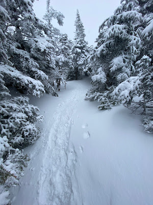
Post hole slime city mess, PLUS about 3" new snow for most of the hike which made it a drag. 


Despite the mess, we had a good hike and enjoyed being able to catch a few views. 

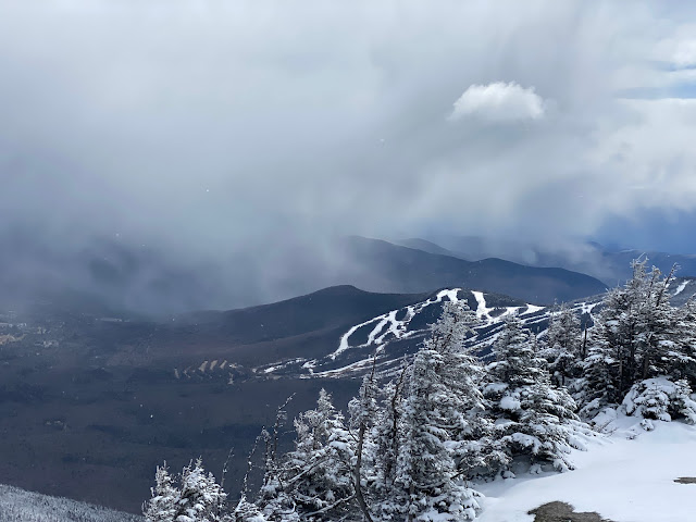
The main summit is always lovely, and we did manage to see off into the distance. 


We could also see things like the next storm coming!


The stretch to the East peak is the hardest part of this hike. Mt. Osceola trail is considerably easier than Greely Pond, so the trickiest stuff you'll find is on the way to East. The chimney bypass was quite passable- and the bypass to the bypass was as well. There were a couple pretty steep stretches that provided a challenge- too much slush for our micro spikes to gain purchase on, but we managed well enough. 

Low quality Summit at east peak. 


But, the sun shone on us!!


And winter was still in full effect. 


We did not crank up the time on the descent as we usually do, conditions were just too shitty. It snowed. It was dumb. We fell in postholes. Growing tired of the tricky conditions, my left foot began squeaking and complaining with a mile of trail to go, which was annoying. Weak ass foot. 


We were happy to get back to the road and make up some time! 

This is a good hike, and a fun one despite the crap. Pure type 2 fun today, to be honest (we cursed a lot...) So this takes care of the Osceolas for spring, April and for this round of the 48. 

And the moral of the story here, is that this is the far easier route up this mountain. 

Miles: 13.1

elevation: 3670

Time: 5:31:52

Fun: 6.5 (but both of us remember it much more fondly now that 6 days have gone by, hahaha!)


Monday, April 11, 2022

Garfield, #23 of round 2 of the NH48

Last time we climbed Garfield it was on a lovely clear summer day- July 5th of 2020 I believe. 

We decided to tackle it in different conditions this time, and an overcast and snowy April day is certainly a stark contrast.

We parked at the gate of there Gale River loop road and enjoyed the 1-ish mile walk in. We love road walks (we do)


The first 2.5 miles of trail were full Spring conditions. some good trail, plenty of wet trail, some mud, the usual. The river crossings were rock hoppable despite the pretty significant rain that had fallen during the week. 


Right at mile 2.5 winter began to arrive in more ways than one. The snow on the ground quite suddenly became significant (although no sign of a monorail on this trail either- perhaps just not enough snowfall this year.) Also, snow began to fall from the sky in a steady manner. 


We had encountered rain on the drive, and clearly, it had snowed in the higher elevations as we discovered about an inch of fresh snow. 


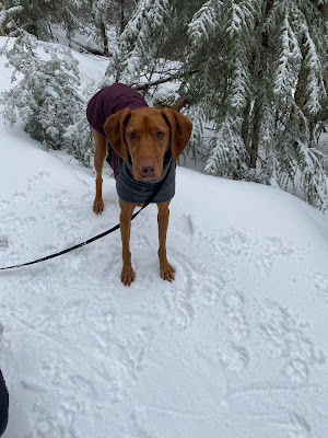
Ellie loves snow, so she had no issue with this!


Garfield Ridge trail is a nice one. It is undoubtedly long (10 miles without the road walk) but it is not too steep until the very final stretch. There are even a few switchbacks to make your day a little easier. 

The final stretch is undeniably steep- and while we got away with micros there would be a real need for crampons in colder/icier weather (the rocks are fully snow/ice covered and it could be tricky to self arrest if you slipped here.)


Anyway, on to the crazy windy freezing summit.


This vantage point boasts one of the best views in the Pemi, believe it or not. Not so much today, but that's alright. We remember how nice it was from last time. Here's a pic from last time, haha. 


We scooted right down. Fucking cold and stupid windy. (for April anyway!) 

Took a pic. It was instantly better weather off the summit. 


Got off the hill lickedy split. 

We like Garfield even in the snow. Always a good time. 

Miles: 12

Elevation gain: 3523

Time: 4:26:44 (like an hour PR even with 2 miles road walk!)

Fun: 8


Friday, April 8, 2022

Hale, #22 of round 2 of the NH 48

Sunday April 3rd, and time to tackle Hale again. 

We did Hale in May of 2019 up the Hale Brook Trail and really enjoyed it,  even though many don't care for Hale (it is a viewless summit.)

Since it is Spring and the Zealand Rd is closed (access road to Hale Brook trailhead, among others) we hiked up the "bushwack" that is the Firewardens Trail. This involves parking at the Seven Dwarfs Motel in Twin Mountain (this little motel may be lovely during peak months, and it's so nice that we are allowed to park here (for $10) But off season, it's a tad spooky.)

From there you hike up Little River road (bearing right at the "Private Road" sign, you go over a couple small bridges and then turn left at the "trail" sign. This takes you up a footpath that connects to Haystack Road. You turn left, and continue to the North Twin Trailhead. From there, you take the North Twin Trail .8 miles until the water crossing. Instead of going right over the river, you bear left, and continue with the river to your right another .3 miles. At this point, on your left, the Firewardens Trail climbs a Rooty bank and bears sharply left. I'm sure this would be VERY easy to notice if you were following snowy footsteps- but you really need to keep an eye open for it this time of year when the ground is bare. (we met a couple at the motel planing to do the same route as us- and we suspect they could not locate this junction as we never saw them again.) FYI- the Gaia app is very useful and accurate (just make sure you have downloaded the trail and have plenty of battery, duh.)

Nice spring conditions until mile 3 when we spiked up. While this is an un-signed, un blazed, and un-maintained trail- someone must take care of it, as some major blowdowns had clearly been chainsawed away. The trail was actually easier to follow than some legit trails we have been on (but we suspect that once the plants grow and leaves develop some places could be much more difficult to follow.)


From mile 3 on, it was winter conditions again. 


We did come across a lovely view, which was a nice surprise on this beautiful day!


We took a couple "shortcuts" along the way- there are lovely switchbacks, and some intrepid hikers had cut the corners off a couple with a more direct path.(bushwhacks within the bushwhack??)  While it was steep in these areas, this generally was a very moderate trail. We enjoyed the lovely birch groves, as well.


Before we knew it, we were there! We spent about 15 minutes soaking up the warm sun and having a snack. Hale is lacking views, but we have never had a bad day on Hale, so it rates pretty high with us. 


We cruised down quickly, and made it back to civilization in good time. 

It was a very quiet day on the hill, despite the very decent weather (forecast to be cloudy- and it was overcast but all high clouds. And NO wind!) We saw 8 other hikers, and that includes the 2 in the parking lot that didn't seem t0 make it, and two others who we saw at the summit who had come from Zealand Road. 

A very good day overall. Checked off Hale for April, and for this round of the 48. 

Miles: 9.2

Elevation: 2541

Time: 3:38:39 (road walks make us fast)

Fun: 8.5 Eric and I agreed that it was a very fun day


Wednesday, April 6, 2022

Tom, Field, Wiley (and Avalon) #19-21 of round 2 of the NH48

Well, due to the continuation of winter weather suckfest 2022, we had a little hiking break before getting around to this monster hike. 

To be accurate, Eric and Ellie had snuck off to set a massive PR on Pierce the weekend before while I was traveling. Hence, they were in good shape and I was not feeling super strong for a hot minute. I ended up being good, but this hike is a sneaky little fucker. 

So right. Sunday March 27, and the best weather that we have had in ages meant 28 degrees up high, snow flurries all day, but thankfully- little to no wind. 

We have hiked these peaks a weird amount considering that none of them really have remarkable merits (except Avalon which can be quite lovely.) This being said, we have never managed to do all 4 in one go, so this was actually a new adventure. Fun!!

We went to Avalon first, which meant climbing up a stupid steep icy hellscape of death. Pretty standard procedure for this trail in the winter. 


After that, of course, it was off to Field. A one mile walk which, oddly, felt like 1200 miles. Gross. 


Thankfully, after that marathon of stupidity, things improved immensely. The walk to Wiley was quite pleasant and we made great time. So much so, that we were actually stunned to come to the summit as quickly as we did (the summit is like, in the woods. There is a lookout a short walk down trail where you can see clouds and snow, if you are lucky like us!)


From there, we absolutely led the CHARGE back to Field, where we were able to point some slightly disoriented hikers in the right direction (we totally get this- for some reason, Field really screws with you. Turn around ONCE and you have no idea where the christ you came from, or are going.) 
We took some silly pics, and then headed off at high speed towards Tom.


We definitely grew progressively snowier, but it was actually a pleasant hiking day, and it was also pretty. 


Tom was lame. I held a Grey Jay which made up for it! Poor Tom. It's just how it is!


We flew down, top speed, and that was that. 

Despite the dubious start, this turned into a good day. What the hell is it with this trio/quad of mountains that is such a grind? I'll admit we made good time, but they are sneaky and harder than one would expect. (and then once you have accepted the suck, they get easier and better. you just need to get Avalon and Field done and then it gets decent.)

Anyway, let's see. That was 19-21 of round 2 (almost half way!) Plus, we checked them off the grid for March. Go us.

Miles: 9.5

Elevation: 3719

Time: 4:19:12

Fun: I say... 7. The first few miles were crap and then it got better
Eric says 8.5, because he is crazy

Tuesday, April 5, 2022

Waumbek (& /Starr King) #18 for round two of the NH48

On March 5th the 3 of us scooted up Waumbek, which meant visiting Starr King as well. 

This was our third trip up these mountains, our second winter trip and first March visit. 

We managed to pick one of the FEW beautiful winter afternoons that we have had. I had to work all morning, but we knew we could easily get this one done before nightfall, even with there late start. 
Winds were predicted to be light (they were) and it was going to be about 35 at the base and 20 at the summit. All very accurate. 

I believe in my first trip report (May, 2019) that I mentioned this was a pleasant and non strenuous hike. We still believe this to be mostly true, but like to add that the first couple miles are undeniably steep. I think when we began hiking with Ellie, we were so used to the above treeline grind of talus and whatnot, that anything less exposed seemed simplistic. We have since logged more miles, and appreciate steep for steep. Which this one is, for a ways. 

Anyway, we made short work of it on this day. Conditions were good, and we are getting our legs back. 


Starr King was lovely as always. 


We had the summit to ourselves, and took a minute to grab a snack and a pic. 


Ellie is never amused by us....


We scooted down even more quickly than we made it up, passing a couple groups along the way. This IS a wonderful mountain too descend, especially in the winter with no rocks. 
We have grown accustomed to being the last people on the mountain because of all our late starts- but today wasn't one of those days. 

Anyway, back to the car well before sunset, and home we went With #18 done and dusted. 

Stats:
Miles- 7.5 (winter parking adds about half a mile)

Elevation: 2876

Time: 2:59 (a PR)

Fun: 8

Sunday, April 3, 2022

Cabot, #17 of round 2 of the NH48

We wrapped up February by hiking Cabot, which is always a stupid idea. 

I kid, I kid. Kind of. I describe Cabot as being "An unexciting and long walk through the woods.... Followed by an unexciting summit.
Let's be really honest right now. That sums it up. It's a long ass walk. 

And it was cold, and snowing. (last time we did it, it was hot and raining....)

This blog is going to be short, because SERIOUSLY, nobody needs to read 2500 words about friggin Cabot. 

Right. It snowed. Bullshit. 


We wore snowshoes because of snow. 

We almost froze in the final mile (even though it's steep AF) because it was sketchy cold and bullshit windy. 

We were so thankful for the cabin!!! There happened to be someone else in there who gave me a funny vibe. That is what happens when you are a woman- you sometimes get a vibe that makes you say "I am glad I'm not alone, even though I am a badass independent female...

We RAN back down the mountain and stopped to take one angry photo. 


We got back to the fish hatchery. It was still snowing and our phones shouted some crazy panic alarms because there was a "snow squall warning...." Anyway, we were done so we did not care, the end. 

Miles: 9 and change

Elevation: 2730

Time: 3:58:26

Fun: I said it was a 5 because at least we got it done, Eric was kind and gave it a 6

Isolation, Sweet 16 of Round 2 of the NH48

Eric, Ellie, Evan and I tackled Isolation on February 21st. 

After a LONG and SHIT winter, we finally scored a quality day. It was better than one could hope for in February- sunny, warm (like 40!) and low low winds. We were all excited, and eager to tackle one of our favorite hills. (Evan's first time on this one!)

The winter route for Isolation starts at Rocky Branch trail, which we all know is a soupy mud mess in many seasons. After climbing this trail for just over 2 miles, you turn right at a tree with a T cut into it (easy to miss!) 


And then take what is known as the Engine Hill Bushwack. It is lovely, and was very easy to follow (there was intel that someone had gone rogue and made a sub-bushwack of lesser quality. since we knew to avoid it, no issues were had!) You chug along this BW for about a mile, and take in the beautiful groves of birch. Really, incredibly pretty. 


From Engine Hill BW, you spend about 50 feet on the actual Isolation trail before heading down a hill to a river crossing, and then you spend a mile on another wonderfully useful BW that people call Isolation Express. (there were a few rambling sub-"trails" but, evidently, all roads lead to the same place at this point.) Iso Express dumps you onto Davis Path- and it's maybe a half mile to the Summit at that point. 


This is a super super route, and even though we LOVED doing this via Glen Boulder in August of '19, this route can not be beat for winter (it IS the major winter route.)

Even though it was kind of dreary at the summit, we all enjoyed the unique view this mountain offers. 


This hike was a ton of fun for so many reasons! We always enjoy sharing our favorite peaks with Evan, and we all enjoyed this trail so much. The weather was AMAZING- Evan is crazy and went shirtless for most of the hike, and yes, people were calling out his crazy. We discovered that certain brands of lemon pepper tuna come with a utensil- SCORE!! There were a good number of other hikers on the trail, but we still had plenty of space to ourselves. AND- none of us fell into the spruce trap! (because someone had, and it was obvious!)

It was a STELLAR day in the mountains. This checked off Isolation for Winter, for February, and for this round of the 48.

Miles: 10.75

Elevation: 3271

Time: 4:27:22

Fun: 10! A perfect day!